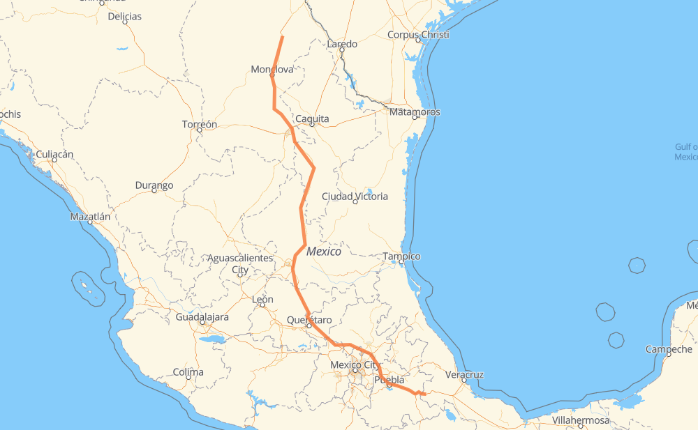
Distance between Sabinas and Fernando López Arias
The distance from Sabinas to Fernando López Arias is 1,372 kilometers by road including 1,085 kilometers on motorways. Road takes approximately 14 hours and 50 minutes and goes through Monclova, San Juan del Rio, Castaños, Arteaga, San Rafael, San Cayetano de Vacas and Ejido La Yerba.
| Shortest distance by air | 1,083 km ✈️ |
| Car route length | 1,372 km 🚗 |
| Driving time | 14 h 50 min |
| Fuel amount | 109.8 L |
| Fuel cost | 195.4 AUD |
| Toll roads cost | 572 + ? MXN |
| Point | Distance | Time | Fuel | |
| Sabinas | 0 km | 00 min | 0.0 L | |
|
MEX 57 115 km, 1 h 20 min
|
||||
| Monclova | 115 km | 1 h 20 min | 8.8 L | |
|
MEX 57 12 km, 09 min
|
||||
| Castaños | 127 km | 1 h 30 min | 9.9 L | |
|
MEX 57 177 km, 1 h 59 min
|
||||
| Arteaga | 304 km | 3 h 29 min | 24.1 L | |
|
MEX 57D 65 km, 38 min
|
||||
| San Rafael | 369 km | 4 h 07 min | 29.2 L | |
|
MEX 57 117 km, 1 h 09 min
|
||||
| San Cayetano de Vacas | 486 km | 5 h 17 min | 36.5 L | |
|
MEX 57 254 km, 2 h 41 min
|
||||
| Delegación de La Pila | 740 km | 7 h 59 min | 57.5 L | |
|
MEX 57D MEX 57 160 km, 1 h 39 min
|
||||
| Parque Industrial Queretaro | 900 km | 9 h 39 min | 71.6 L | |
|
MEX 57 MEX 57D 72 km, 48 min
|
||||
| San Juan del Rio | 972 km | 10 h 27 min | 77.2 L | |
|
MEX 57 MEX M40D 404 km, 4 h 22 min
|
||||
| Reforma | 1,376 km | 14 h 50 min | 110.1 L | |
Frequently Asked Questions
How many toll booths are there from Sabinas to Fernando López Arias?
There are 12 toll booths between Sabinas and Fernando López Arias: La Carbonera, Los Chorros, Matehuala Omega, Libramiento Oriente De SLP, Chichimequillas, Queretaro, Palmillas, San Martin Texmelucan, San Martín, Viaducto Elevado de Puebla, Amozoc and Esperanza 27.
How much does the toll booths cost from Sabinas to Fernando López Arias?
Toll roads cost: La Carbonera (42 MXN) + Los Chorros (66 MXN) + Matehuala Omega (?) + Libramiento Oriente De SLP (70 MXN) + Chichimequillas (51 MXN) + Palmillas (89 MXN) + Queretaro (?) + San Martin Texmelucan (?) + San Martín (42 MXN) + Viaducto Elevado de Puebla (?) + Amozoc (72 MXN) + Esperanza 27 (140 MXN) = 572 + ? MXN
How much does it cost to drive from Sabinas to Fernando López Arias?
Fuel cost: 195.4 AUD
This fuel cost is calculated as: (Route length 1,372 km / 100 km) * (Fuel consumption 8 L/100 km) * (Fuel price 1.78 AUD / L)
You can adjust fuel consumption and fuel price here.
Toll roads cost: 572 + ? MXN
How long is a car ride from Sabinas to Fernando López Arias?
Driving time: 14 h 50 min
This time is calculated for driving at the maximum permitted speed, taking into account traffic rules restrictions.
- 129 km with a maximum speed 110 km/h = 1 h 10 min
- 567 km with a maximum speed 100 km/h = 5 h 39 min
- 425 km with a maximum speed 90 km/h = 4 h 43 min
- 239 km with a maximum speed 80 km/h = 2 h 59 min
- 5 km with a maximum speed 70 km/h = 4 min
- 1 km with a maximum speed 60 km/h = 1 min
- 9 km with a maximum speed 50 km/h = 10 min
The calculated driving time does not take into account intermediate stops and traffic jams.
How far is Sabinas to Fernando López Arias by land?
The distance between Sabinas and Fernando López Arias is 1,372 km by road including 1,085 km on motorways.
Precise satellite coordinates of highways were used for this calculation. The start and finish points are the centers of Sabinas and Fernando López Arias respectively.
How far is Sabinas to Fernando López Arias by plane?
The shortest distance (air line, as the crow flies) between Sabinas and Fernando López Arias is 1,083 km.
This distance is calculated using the Haversine formula as a great-circle distance between two points on the surface of a sphere. The start and finish points are the centers of Sabinas and Fernando López Arias respectively. Actual distance between airports may be different.
How many hours is Sabinas from Fernando López Arias by plane?
Boeing 737 airliner needs 1 h 21 min to cover the distance of 1,083 km at a cruising speed of 800 km/h.
Small plane "Cessna 172" needs 4 h 55 min to flight this distance at average speed of 220 km/h.
This time is approximate and do not take into account takeoff and landing times, airport location and other real world factors.
How long is a helicopter ride from Sabinas to Fernando López Arias?
Fast helicopter "Eurocopter AS350" or "Hughes OH-6 Cayuse" need 4 h 30 min to cover the distance of 1,083 km at a cruising speed of 240 km/h.
Popular "Robinson R44" needs 5 h 9 min to flight this distance at average speed of 210 km/h.
This time is approximate and do not take into account takeoff and landing times, aerodrome location and other real world factors.
What city is halfway between Sabinas and Fernando López Arias?
The halfway point between Sabinas and Fernando López Arias is Huizache. It is located about 27 km from the exact midpoint by road.
The distance from Huizache to Sabinas is 660 km and driving will take about 7 h 8 min. The road between Huizache and Fernando López Arias has length 713 km and will take approximately 7 h 42 min.
The other cities located close to halfway point:
Where is Sabinas in relation to Fernando López Arias?
Sabinas is located 1,083 km north-west of Fernando López Arias.
Sabinas has geographic coordinates: latitude 27.85319, longitude -101.12679.
Fernando López Arias has geographic coordinates: latitude 18.81546, longitude -97.18578.
Which highway goes from Sabinas to Fernando López Arias?
The route from Sabinas to Fernando López Arias follows MEX 57, MEX 57D, MEX M40D, MEX 150D.
Other minor sections pass along the road:
- MEX 80: 82 km
- MEX 45: 40 km
- MEX 120: 12 km