Distance between San Pablo de Tushmo and Sanganato
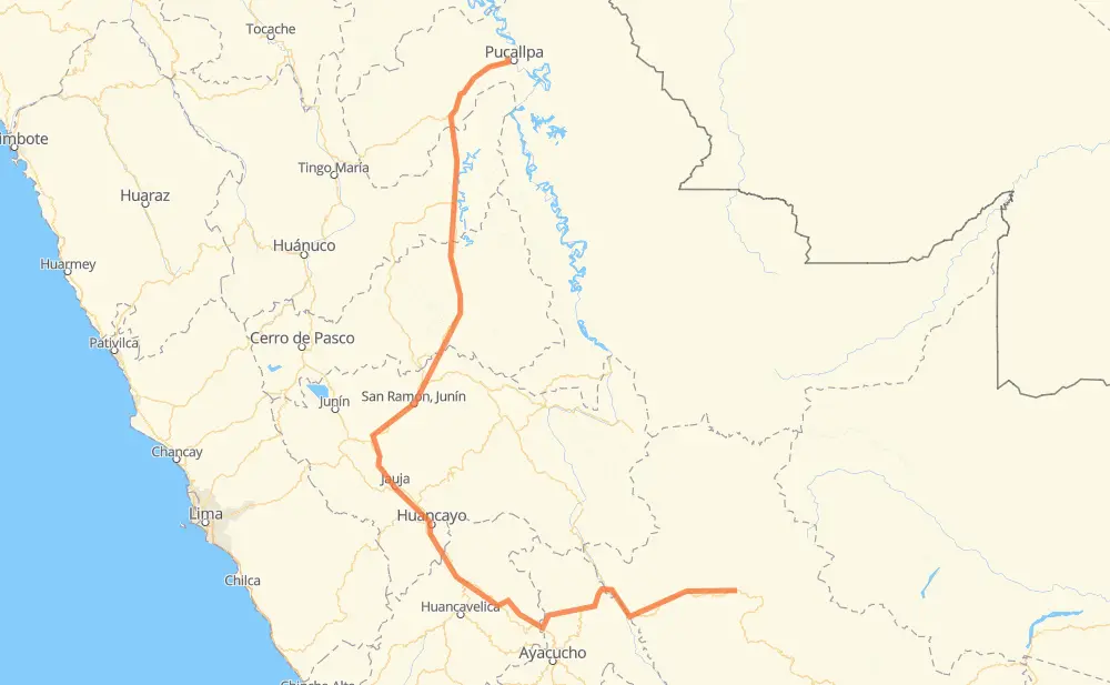
The distance from San Pablo de Tushmo to Sanganato is 1,190 kilometers by road. Road takes approximately 18 hours and 34 minutes and goes through Pucallpa, Huancayo, Primavera, Campo Verde, Neshuya, Ciudad Constitución and Villa Rica.
| Shortest distance by air | 514 km ✈️ |
| Car route length | 1,190 km 🚗 |
| Driving time | 18 h 34 min |
| Fuel amount | 95.2 L |
| Fuel cost | 167.5 AUD |
| Point | Distance | Time | Fuel | |
| San Pablo de Tushmo | 0 km | 00 min | 0.0 L | |
|
11 km, 09 min
|
||||
| Primavera | 11 km | 09 min | 0.5 L | |
|
PE-18C 22 km, 15 min
|
||||
| Campo Verde | 33 km | 25 min | 1.3 L | |
|
PE-18C 31 km, 21 min
|
||||
| Neshuya | 64 km | 47 min | 3.9 L | |
|
PE-18C PE-5N 148 km, 2 h 45 min
|
||||
| Ciudad Constitución | 211 km | 3 h 32 min | 16.2 L | |
|
PE-5N 152 km, 3 h 07 min
|
||||
| Villa Rica | 363 km | 6 h 40 min | 28.4 L | |
|
PE-5N 23 km, 25 min
|
||||
| Miraflores | 387 km | 7 h 06 min | 30.8 L | |
|
PE-5N 29 km, 27 min
|
||||
| Kimiri | 416 km | 7 h 34 min | 33.0 L | |
|
PE-22B 167 km, 2 h 15 min
|
||||
| Huancayo | 582 km | 9 h 50 min | 44.6 L | |
|
PE-3SB PE-28B 655 km, 8 h 49 min
|
||||
| Talangato | 1,238 km | 18 h 39 min | 98.8 L | |
Frequently Asked Questions
How much does it cost to drive from San Pablo de Tushmo to Sanganato?
Fuel cost: 167.5 AUD
This fuel cost is calculated as: (Route length 1,190 km / 100 km) * (Fuel consumption 8 L/100 km) * (Fuel price 1.76 AUD / L)
You can adjust fuel consumption and fuel price here.
How long is a car ride from San Pablo de Tushmo to Sanganato?
Driving time: 18 h 34 min
This time is calculated for driving at the maximum permitted speed, taking into account traffic rules restrictions.
- 266 km with a maximum speed 90 km/h = 2 h 57 min
- 516 km with a maximum speed 80 km/h = 6 h 27 min
- 138 km with a maximum speed 60 km/h = 2 h 17 min
- 184 km with a maximum speed 50 km/h = 3 h 40 min
- 113 km with a maximum speed 40 km/h = 2 h 49 min
- 9 km with a maximum speed 35 km/h = 15 min
- 2 km with a maximum speed 30 km/h = 3 min
The calculated driving time does not take into account intermediate stops and traffic jams.
How far is San Pablo de Tushmo to Sanganato by land?
The distance between San Pablo de Tushmo and Sanganato is 1,190 km by road.
Precise satellite coordinates of highways were used for this calculation. The start and finish points are the centers of San Pablo de Tushmo and Sanganato respectively.
How far is San Pablo de Tushmo to Sanganato by plane?
The shortest distance (air line, as the crow flies) between San Pablo de Tushmo and Sanganato is 514 km.
This distance is calculated using the Haversine formula as a great-circle distance between two points on the surface of a sphere. The start and finish points are the centers of San Pablo de Tushmo and Sanganato respectively. Actual distance between airports may be different.
How many hours is San Pablo de Tushmo from Sanganato by plane?
Boeing 737 airliner needs 38 min to cover the distance of 514 km at a cruising speed of 800 km/h.
Small plane "Cessna 172" needs 2 h 20 min to flight this distance at average speed of 220 km/h.
This time is approximate and do not take into account takeoff and landing times, airport location and other real world factors.
How long is a helicopter ride from San Pablo de Tushmo to Sanganato?
Fast helicopter "Eurocopter AS350" or "Hughes OH-6 Cayuse" need 2 h 8 min to cover the distance of 514 km at a cruising speed of 240 km/h.
Popular "Robinson R44" needs 2 h 26 min to flight this distance at average speed of 210 km/h.
This time is approximate and do not take into account takeoff and landing times, aerodrome location and other real world factors.
What city is halfway between San Pablo de Tushmo and Sanganato?
The halfway point between San Pablo de Tushmo and Sanganato is Huancayo. It is located about 12 km from the exact midpoint by road.
The distance from Huancayo to San Pablo de Tushmo is 582 km and driving will take about 9 h 49 min. The road between Huancayo and Sanganato has length 607 km and will take approximately 8 h 44 min.
The other cities located close to halfway point:
Where is San Pablo de Tushmo in relation to Sanganato?
San Pablo de Tushmo is located 514 km north-west of Sanganato.
San Pablo de Tushmo has geographic coordinates: latitude -8.3527, longitude -74.59458.
Sanganato has geographic coordinates: latitude -12.6003, longitude -72.73209.
Which highway goes from San Pablo de Tushmo to Sanganato?
The route from San Pablo de Tushmo to Sanganato follows PE-5N, PE-28B, PE-3S.
Other minor sections pass along the road:
- PE-22B: 85 km
- PE-18C: 79 km
- PE-3SM: 67 km
- PE-3SA: 62 km
- HV-106: 49 km
- PE-3SB: 40 km
- AY-100: 38 km
- 3S: 5 km