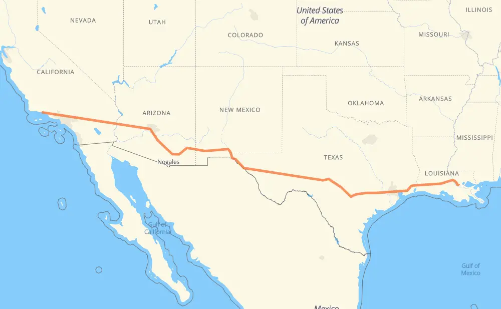
The distance from Santa Barbara to McElroy is 3,123 kilometers by road including 3,105 kilometers on motorways. Road takes approximately 30 hours and 1 minute and goes through Ventura, Thousand Oaks, Los Angeles, Burbank, Glendale, Pasadena and Arcadia.
How much does it cost to drive from Santa Barbara to McElroy?
Fuel cost:
444.7 AUD
This fuel cost is calculated as: (Route length 3,123 km / 100 km) * (Fuel consumption 8 L/100 km) * (Fuel price 1.78 AUD / L)
You can adjust fuel consumption and fuel price here.
How long is a car ride from Santa Barbara to McElroy?
Driving time:
30 h 1 min
This time is calculated for driving at the maximum permitted speed, taking into account traffic rules restrictions.
1,902 km with a maximum speed 110 km/h = 17 h 17 min
436 km with a maximum speed 105 km/h = 4 h 9 min
384 km with a maximum speed 100 km/h = 3 h 50 min
112 km with a maximum speed 97 km/h = 1 h 9 min
15 km with a maximum speed 90 km/h = 9 min
28 km with a maximum speed 89 km/h = 19 min
3 km with a maximum speed 80 km/h = 1 min
242 km with a maximum speed 80 km/h = 3 h 1 min
The calculated driving time does not take into account intermediate stops and traffic jams.
How far is Santa Barbara to McElroy by land?
The distance between Santa Barbara and McElroy is 3,123 km by road including 3,105 km on motorways.
Precise satellite coordinates of highways were used for this calculation. The start and finish points are the centers of Santa Barbara and McElroy respectively.
How far is Santa Barbara to McElroy by plane?
The shortest distance (air line, as the crow flies) between Santa Barbara and McElroy is 2,750 km.
This distance is calculated using the Haversine formula as a great-circle distance between two points on the surface of a sphere. The start and finish points are the centers of Santa Barbara and McElroy respectively. Actual distance between airports may be different.
How many hours is Santa Barbara from McElroy by plane?
Boeing 737 airliner needs 3 h 26 min to cover the distance of 2,750 km at a cruising speed of 800 km/h.
Small plane "Cessna 172" needs 12 h 30 min to flight this distance at average speed of 220 km/h.
This time is approximate and do not take into account takeoff and landing times, airport location and other real world factors.
How long is a helicopter ride from Santa Barbara to McElroy?
Fast helicopter "Eurocopter AS350" or "Hughes OH-6 Cayuse" need 11 h 27 min to cover the distance of 2,750 km at a cruising speed of 240 km/h.
Popular "Robinson R44" needs 13 h 5 min to flight this distance at average speed of 210 km/h.
This time is approximate and do not take into account takeoff and landing times, aerodrome location and other real world factors.
What city is halfway between Santa Barbara and McElroy?
The halfway point between Santa Barbara and McElroy is Etholen. It is located about 51 km from the exact midpoint by road.
The distance from Etholen to Santa Barbara is 1,612 km and driving will take about 15 h 36 min. The road between Etholen and McElroy has length 1,510 km and will take approximately 14 h 24 min.
The other cities located close to halfway point:
Socorro is in 1,508 km from Santa Barbara and 1,614 km from McElroy
Sierra Blanca is in 1,618 km from Santa Barbara and 1,504 km from McElroy
Arispe is in 1,629 km from Santa Barbara and 1,494 km from McElroy
Where is Santa Barbara in relation to McElroy?
Santa Barbara is located 2,750 km west of McElroy.
Santa Barbara has geographic coordinates: latitude 34.42213, longitude -119.70267.
McElroy has geographic coordinates: latitude 30.14048, longitude -90.79148.
Which highway goes from Santa Barbara to McElroy?
The route from Santa Barbara to McElroy follows I 10, US 70, US 101, US 180, US 90.