Distance between Santa Maria CA and Spring Valley NV
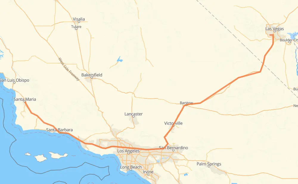
The distance from Santa Maria to Spring Valley is 676 kilometers by road including 588 kilometers on motorways. Road takes approximately 6 hours and 31 minutes and goes through Santa Barbara, Ventura, Thousand Oaks, Los Angeles, Burbank, Glendale and Pasadena.
| Shortest distance by air | 487 km ✈️ |
| Car route length | 676 km 🚗 |
| Driving time | 6 h 31 min |
| Fuel amount | 54 L |
| Fuel cost | 97.8 AUD |
| Point | Distance | Time | Fuel | |
| Santa Maria | 0 km | 00 min | 0.0 L | |
|
US 101 CA 154 101 km, 1 h 06 min
|
||||
| Santa Barbara | 101 km | 1 h 06 min | 7.5 L | |
|
US 101 45 km, 26 min
|
||||
| Ventura | 146 km | 1 h 32 min | 11.4 L | |
|
US 101 42 km, 24 min
|
||||
| Thousand Oaks | 188 km | 1 h 57 min | 14.2 L | |
|
US 101 63 km, 36 min
|
||||
| Los Angeles | 251 km | 2 h 34 min | 16.7 L | |
|
US 101 46 km, 26 min
|
||||
| Pasadena | 297 km | 3 h 00 min | 23.4 L | |
|
I 210 7 km, 04 min
|
||||
| Arcadia | 304 km | 3 h 04 min | 24.1 L | |
|
I 210 4 km, 02 min
|
||||
| Monrovia | 308 km | 3 h 06 min | 24.5 L | |
|
I 210 9 km, 05 min
|
||||
| Azusa | 317 km | 3 h 11 min | 25.1 L | |
|
I 210 CA 210 37 km, 21 min
|
||||
| Rancho Cucamonga | 353 km | 3 h 33 min | 27.5 L | |
|
CA 210 10 km, 05 min
|
||||
| Fontana | 364 km | 3 h 39 min | 29.1 L | |
|
I 15 44 km, 24 min
|
||||
| Victorville | 408 km | 4 h 03 min | 31.6 L | |
|
I 15 303 km, 2 h 47 min
|
||||
| Spring Valley | 711 km | 6 h 51 min | 56.5 L | |
Frequently Asked Questions
How much does it cost to drive from Santa Maria to Spring Valley?
Fuel cost: 97.8 AUD
This fuel cost is calculated as: (Route length 676 km / 100 km) * (Fuel consumption 8 L/100 km) * (Fuel price 1.81 AUD / L)
You can adjust fuel consumption and fuel price here.
How long is a car ride from Santa Maria to Spring Valley?
Driving time: 6 h 31 min
This time is calculated for driving at the maximum permitted speed, taking into account traffic rules restrictions.
- 328 km with a maximum speed 110 km/h = 2 h 58 min
- 237 km with a maximum speed 105 km/h = 2 h 16 min
- 5 km with a maximum speed 100 km/h = 2 min
- 63 km with a maximum speed 90 km/h = 42 min
- 11 km with a maximum speed 89 km/h = 7 min
- 30 km with a maximum speed 80 km/h = 22 min
- 1 km with a maximum speed 72 km/h = 1 min
The calculated driving time does not take into account intermediate stops and traffic jams.
How far is Santa Maria to Spring Valley by land?
The distance between Santa Maria and Spring Valley is 676 km by road including 588 km on motorways.
Precise satellite coordinates of highways were used for this calculation. The start and finish points are the centers of Santa Maria and Spring Valley respectively.
How far is Santa Maria to Spring Valley by plane?
The shortest distance (air line, as the crow flies) between Santa Maria and Spring Valley is 487 km.
This distance is calculated using the Haversine formula as a great-circle distance between two points on the surface of a sphere. The start and finish points are the centers of Santa Maria and Spring Valley respectively. Actual distance between airports may be different.
How many hours is Santa Maria from Spring Valley by plane?
Boeing 737 airliner needs 36 min to cover the distance of 487 km at a cruising speed of 800 km/h.
Small plane "Cessna 172" needs 2 h 12 min to flight this distance at average speed of 220 km/h.
This time is approximate and do not take into account takeoff and landing times, airport location and other real world factors.
How long is a helicopter ride from Santa Maria to Spring Valley?
Fast helicopter "Eurocopter AS350" or "Hughes OH-6 Cayuse" need 2 h 1 min to cover the distance of 487 km at a cruising speed of 240 km/h.
Popular "Robinson R44" needs 2 h 19 min to flight this distance at average speed of 210 km/h.
This time is approximate and do not take into account takeoff and landing times, aerodrome location and other real world factors.
What city is halfway between Santa Maria and Spring Valley?
The halfway point between Santa Maria and Spring Valley is Claremont. It is located about 1 km from the exact midpoint by road.
The distance from Claremont to Santa Maria is 336 km and driving will take about 3 h 23 min. The road between Claremont and Spring Valley has length 339 km and will take approximately 3 h 8 min.
The other cities located close to halfway point:
Where is Santa Maria in relation to Spring Valley?
Santa Maria is located 487 km west of Spring Valley.
Santa Maria has geographic coordinates: latitude 34.95313, longitude -120.43586.
Spring Valley has geographic coordinates: latitude 36.11114, longitude -115.24287.
Which highway goes from Santa Maria to Spring Valley?
The route from Santa Maria to Spring Valley follows I 15, US 101.
Other minor sections pass along the road:
- CA 154: 52 km
- CA 134: 32 km
- CA 210: 31 km
- I 210: 30 km
- CA 18: 4 km
- CA 23: 2 km
- CA 166: 2 km
- NV 595: 1 km