Distance between Santos and São Vicente
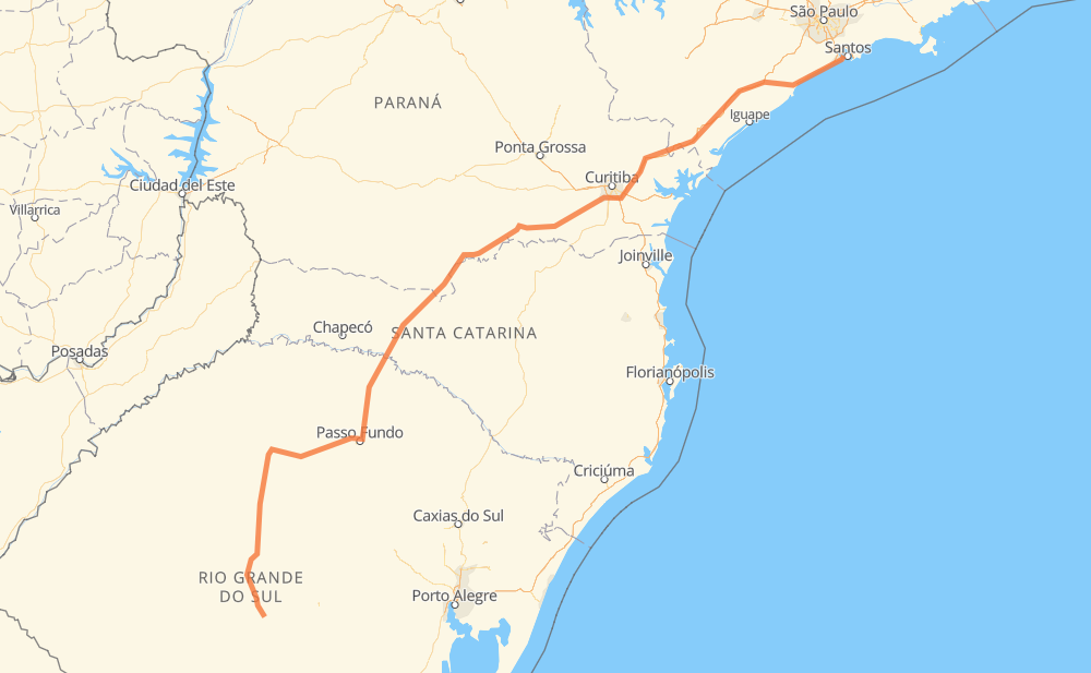
The distance from Santos to São Vicente is 1,288 kilometers by road including 377 kilometers on motorways. Road takes approximately 15 hours and 3 minutes and goes through Piraquara, Lorenzi, Sede, Chácaras do Sul, Linha Água Verde, Posto Cem and Ganchinho.
| Shortest distance by air | 992 km ✈️ |
| Car route length | 1,288 km 🚗 |
| Driving time | 15 h 3 min |
| Fuel amount | 103 L |
| Fuel cost | 185.5 AUD |
| Point | Distance | Time | Fuel | |
| Santos | 0 km | 00 min | 0.0 L | |
|
BR-392 54 km, 36 min
|
||||
| Lorenzi | 54 km | 36 min | 4.2 L | |
|
BR-392 BR-158 6 km, 05 min
|
||||
| Sede | 60 km | 41 min | 4.7 L | |
|
BR-158 122 km, 1 h 28 min
|
||||
| Chácaras do Sul | 182 km | 2 h 09 min | 14.3 L | |
|
BR-158 BR-285 291 km, 3 h 36 min
|
||||
| Linha Água Verde | 474 km | 5 h 46 min | 37.3 L | |
|
BR-153 16 km, 11 min
|
||||
| Posto Cem | 489 km | 5 h 58 min | 38.7 L | |
|
BR-153 BR-476 397 km, 4 h 29 min
|
||||
| Ganchinho | 887 km | 10 h 27 min | 70.6 L | |
|
BR-116 26 km, 15 min
|
||||
| Piraquara | 913 km | 10 h 43 min | 72.4 L | |
|
BR-116 70 km, 51 min
|
||||
| Antonina | 983 km | 11 h 34 min | 77.2 L | |
|
BR-116 324 km, 3 h 28 min
|
||||
| São Vicente | 1,307 km | 15 h 02 min | 104.4 L | |
Hotels of São Vicente
Frequently Asked Questions
How much does it cost to drive from Santos to São Vicente?
Fuel cost: 185.5 AUD
This fuel cost is calculated as: (Route length 1,288 km / 100 km) * (Fuel consumption 8 L/100 km) * (Fuel price 1.8 AUD / L)
You can adjust fuel consumption and fuel price here.
How long is a car ride from Santos to São Vicente?
Driving time: 15 h 3 min
This time is calculated for driving at the maximum permitted speed, taking into account traffic rules restrictions.
- 202 km with a maximum speed 110 km/h = 1 h 50 min
- 55 km with a maximum speed 100 km/h = 32 min
- 620 km with a maximum speed 90 km/h = 6 h 53 min
- 356 km with a maximum speed 80 km/h = 4 h 27 min
- 60 km with a maximum speed 60 km/h = 59 min
- 7 km with a maximum speed 50 km/h = 8 min
- 7 km with a maximum speed 40 km/h = 10 min
The calculated driving time does not take into account intermediate stops and traffic jams.
How far is Santos to São Vicente by land?
The distance between Santos and São Vicente is 1,288 km by road including 377 km on motorways.
Precise satellite coordinates of highways were used for this calculation. The start and finish points are the centers of Santos and São Vicente respectively.
How far is Santos to São Vicente by plane?
The shortest distance (air line, as the crow flies) between Santos and São Vicente is 992 km.
This distance is calculated using the Haversine formula as a great-circle distance between two points on the surface of a sphere. The start and finish points are the centers of Santos and São Vicente respectively. Actual distance between airports may be different.
How many hours is Santos from São Vicente by plane?
Boeing 737 airliner needs 1 h 14 min to cover the distance of 992 km at a cruising speed of 800 km/h.
Small plane "Cessna 172" needs 4 h 30 min to flight this distance at average speed of 220 km/h.
This time is approximate and do not take into account takeoff and landing times, airport location and other real world factors.
How long is a helicopter ride from Santos to São Vicente?
Fast helicopter "Eurocopter AS350" or "Hughes OH-6 Cayuse" need 4 h 8 min to cover the distance of 992 km at a cruising speed of 240 km/h.
Popular "Robinson R44" needs 4 h 43 min to flight this distance at average speed of 210 km/h.
This time is approximate and do not take into account takeoff and landing times, aerodrome location and other real world factors.
What city is halfway between Santos and São Vicente?
The halfway point between Santos and São Vicente is Linha Caroveira. It is located about 124 km from the exact midpoint by road.
The distance from Linha Caroveira to Santos is 520 km and driving will take about 6 h 20 min. The road between Linha Caroveira and São Vicente has length 768 km and will take approximately 8 h 42 min.
The other cities located close to halfway point:
Where is Santos in relation to São Vicente?
Santos is located 992 km south-west of São Vicente.
Santos has geographic coordinates: latitude -30.16878, longitude -53.58912.
São Vicente has geographic coordinates: latitude -23.96037, longitude -46.3847.
Which highway goes from Santos to São Vicente?
The route from Santos to São Vicente follows BR-116, BR-153, BR-476, SP-230, BR-158, BR-392, BR-285.
Other minor sections pass along the road:
- SP-055: 99 km
- BR-101: 99 km
- ERS-135: 72 km
- BR-478: 48 km
- BR-277: 22 km
- SPA 291/055: 8 km