Distance between Selkirk MB and Rouyn-Noranda QC
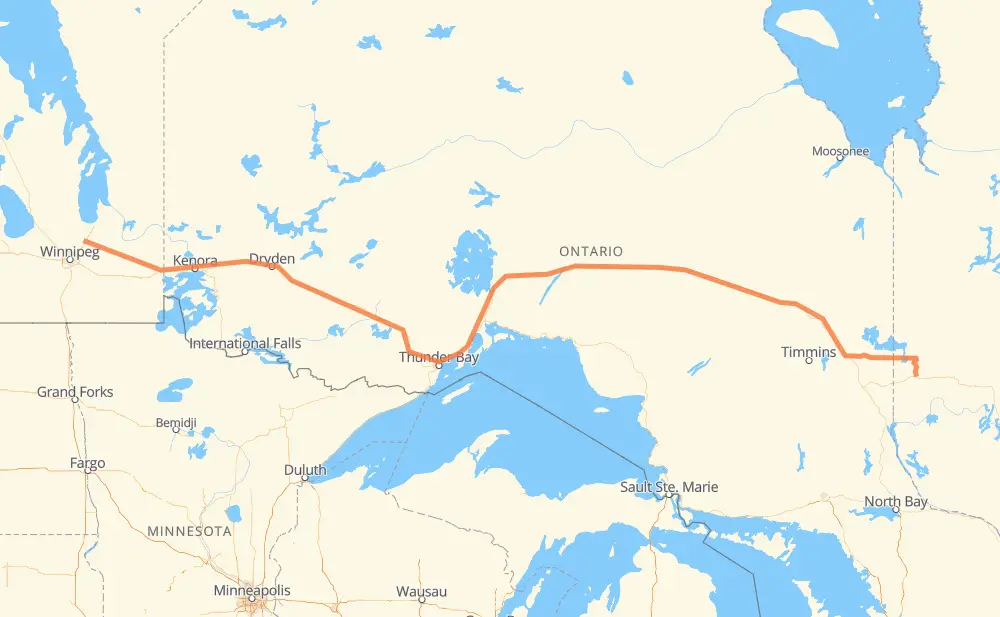
The distance from Selkirk to Rouyn-Noranda is 1,636 kilometers by road including 6 kilometers on motorways. Road takes approximately 18 hours and 44 minutes and goes through Kenora, Dryden, Thunder Bay, Tyndall, Whitemouth, West Hawk Lake and Ignace.
| Shortest distance by air | 1,312 km ✈️ |
| Car route length | 1,636 km 🚗 |
| Driving time | 18 h 44 min |
| Fuel amount | 130.9 L |
| Fuel cost | 236.8 AUD |
| Point | Distance | Time | Fuel | |
| Selkirk | 0 km | 00 min | 0.0 L | |
|
PR 204 PTH 44 30 km, 21 min
|
||||
| Tyndall | 30 km | 21 min | 1.9 L | |
|
PTH 44 50 km, 33 min
|
||||
| Whitemouth | 80 km | 55 min | 5.6 L | |
|
PTH 11 PTH 44 67 km, 45 min
|
||||
| West Hawk Lake | 146 km | 1 h 40 min | 10.8 L | |
|
PTH 44 17 63 km, 42 min
|
||||
| Kenora | 210 km | 2 h 23 min | 16.5 L | |
|
17A 17 146 km, 1 h 40 min
|
||||
| Dryden | 356 km | 4 h 03 min | 27.8 L | |
|
17 99 km, 1 h 09 min
|
||||
| Ignace | 455 km | 5 h 12 min | 35.4 L | |
|
17 235 km, 2 h 37 min
|
||||
| Thunder Bay | 690 km | 7 h 50 min | 55.1 L | |
|
17 11 108 km, 1 h 12 min
|
||||
| Nipigon | 798 km | 9 h 03 min | 63.3 L | |
|
11 838 km, 9 h 40 min
|
||||
| Rouyn-Noranda | 1,636 km | 18 h 44 min | 130.3 L | |
Hotels of Rouyn-Noranda
Frequently Asked Questions
How much does it cost to drive from Selkirk to Rouyn-Noranda?
Fuel cost: 236.8 AUD
This fuel cost is calculated as: (Route length 1,636 km / 100 km) * (Fuel consumption 8 L/100 km) * (Fuel price 1.81 AUD / L)
You can adjust fuel consumption and fuel price here.
How long is a car ride from Selkirk to Rouyn-Noranda?
Driving time: 18 h 44 min
This time is calculated for driving at the maximum permitted speed, taking into account traffic rules restrictions.
- 1,454 km with a maximum speed 90 km/h = 16 h 9 min
- 105 km with a maximum speed 80 km/h = 1 h 18 min
- 35 km with a maximum speed 70 km/h = 30 min
- 21 km with a maximum speed 60 km/h = 20 min
- 21 km with a maximum speed 50 km/h = 25 min
The calculated driving time does not take into account intermediate stops and traffic jams.
How far is Selkirk to Rouyn-Noranda by land?
The distance between Selkirk and Rouyn-Noranda is 1,636 km by road including 6 km on motorways.
Precise satellite coordinates of highways were used for this calculation. The start and finish points are the centers of Selkirk and Rouyn-Noranda respectively.
How far is Selkirk to Rouyn-Noranda by plane?
The shortest distance (air line, as the crow flies) between Selkirk and Rouyn-Noranda is 1,312 km.
This distance is calculated using the Haversine formula as a great-circle distance between two points on the surface of a sphere. The start and finish points are the centers of Selkirk and Rouyn-Noranda respectively. Actual distance between airports may be different.
How many hours is Selkirk from Rouyn-Noranda by plane?
Boeing 737 airliner needs 1 h 38 min to cover the distance of 1,312 km at a cruising speed of 800 km/h.
Small plane "Cessna 172" needs 5 h 57 min to flight this distance at average speed of 220 km/h.
This time is approximate and do not take into account takeoff and landing times, airport location and other real world factors.
How long is a helicopter ride from Selkirk to Rouyn-Noranda?
Fast helicopter "Eurocopter AS350" or "Hughes OH-6 Cayuse" need 5 h 28 min to cover the distance of 1,312 km at a cruising speed of 240 km/h.
Popular "Robinson R44" needs 6 h 14 min to flight this distance at average speed of 210 km/h.
This time is approximate and do not take into account takeoff and landing times, aerodrome location and other real world factors.
What city is halfway between Selkirk and Rouyn-Noranda?
The halfway point between Selkirk and Rouyn-Noranda is Orient Bay. It is located about 9 km from the exact midpoint by road.
The distance from Orient Bay to Selkirk is 827 km and driving will take about 9 h 23 min. The road between Orient Bay and Rouyn-Noranda has length 809 km and will take approximately 9 h 21 min.
The other cities located close to halfway point:
Where is Selkirk in relation to Rouyn-Noranda?
Selkirk is located 1,312 km west of Rouyn-Noranda.
Selkirk has geographic coordinates: latitude 50.14699, longitude -96.88019.
Rouyn-Noranda has geographic coordinates: latitude 48.24205, longitude -79.02054.
Which highway goes from Selkirk to Rouyn-Noranda?
The route from Selkirk to Rouyn-Noranda follows 11, 17, PTH 44, 101.
Other minor sections pass along the road:
- 17A: 33 km
- 102: 33 km
- 388: 22 km
- PTH 11: 20 km
- 393: 16 km
- PTH 12: 10 km
- PTH 59: 5 km
- PTH 1: 4 km
- PR 204: 3 km
- PR 509: 2 km
- 117: 1 km
- 583: 1 km