Distance between Tecamachalco and Huauchinango
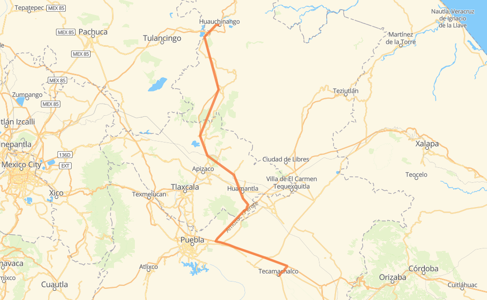
The distance from Tecamachalco to Huauchinango is 216 kilometers by road including 44 kilometers on motorways. Road takes approximately 2 hours and 26 minutes and goes through Acatzingo de Hidalgo, San José Tuzuapan, Progreso de Juárez, San Bartolomé Hueyapan, San Jerónimo Ocotitlán, Beristáin and La Bóveda.
| Shortest distance by air | 147 km ✈️ |
| Car route length | 216 km 🚗 |
| Driving time | 2 h 26 min |
| Fuel amount | 17.3 L |
| Fuel cost | 30.4 AUD |
| Toll roads cost | 153 + ? MXN |
| Point | Distance | Time | Fuel | |
| Tecamachalco | 0 km | 00 min | 0.0 L | |
|
3 km, 02 min
|
||||
| San Gregorio Tlacomulco | 3 km | 02 min | 0.2 L | |
|
PUE 714 2 km, 01 min
|
||||
| San José Tuzuapan | 5 km | 04 min | 0.4 L | |
|
PUE 714 MEX 150D 11 km, 06 min
|
||||
| Acatzingo de Hidalgo | 16 km | 10 min | 0.8 L | |
|
MEX 150D 13 km, 07 min
|
||||
| San Bartolomé Hueyapan | 29 km | 18 min | 1.7 L | |
|
MEX 150D 10 km, 05 min
|
||||
| San Jerónimo Ocotitlán | 40 km | 23 min | 3.1 L | |
|
MEX 150D MEX 119D 154 km, 1 h 45 min
|
||||
| Beristáin | 193 km | 2 h 09 min | 15.3 L | |
|
MEX 119D 5 km, 03 min
|
||||
| La Bóveda | 198 km | 2 h 12 min | 15.8 L | |
|
MEX 119 4 km, 02 min
|
||||
| Venta Grande | 202 km | 2 h 15 min | 15.9 L | |
|
MEX 130 14 km, 11 min
|
||||
| Huauchinango | 216 km | 2 h 26 min | 16.4 L | |
Hotels of Huauchinango
Frequently Asked Questions
How many toll booths are there from Tecamachalco to Huauchinango?
How much does the toll booths cost from Tecamachalco to Huauchinango?
How much does it cost to drive from Tecamachalco to Huauchinango?
Fuel cost: 30.4 AUD
This fuel cost is calculated as: (Route length 216 km / 100 km) * (Fuel consumption 8 L/100 km) * (Fuel price 1.76 AUD / L)
You can adjust fuel consumption and fuel price here.
Toll roads cost: 153 + ? MXN
How long is a car ride from Tecamachalco to Huauchinango?
Driving time: 2 h 26 min
This time is calculated for driving at the maximum permitted speed, taking into account traffic rules restrictions.
- 27 km with a maximum speed 110 km/h = 14 min
- 12 km with a maximum speed 100 km/h = 7 min
- 119 km with a maximum speed 90 km/h = 1 h 19 min
- 54 km with a maximum speed 80 km/h = 40 min
- 2 km with a maximum speed 50 km/h = 2 min
- 1 km with a maximum speed 40 km/h = 1 min
The calculated driving time does not take into account intermediate stops and traffic jams.
How far is Tecamachalco to Huauchinango by land?
The distance between Tecamachalco and Huauchinango is 216 km by road including 44 km on motorways.
Precise satellite coordinates of highways were used for this calculation. The start and finish points are the centers of Tecamachalco and Huauchinango respectively.
How far is Tecamachalco to Huauchinango by plane?
The shortest distance (air line, as the crow flies) between Tecamachalco and Huauchinango is 147 km.
This distance is calculated using the Haversine formula as a great-circle distance between two points on the surface of a sphere. The start and finish points are the centers of Tecamachalco and Huauchinango respectively. Actual distance between airports may be different.
How many hours is Tecamachalco from Huauchinango by plane?
Boeing 737 airliner needs 11 min to cover the distance of 147 km at a cruising speed of 800 km/h.
Small plane "Cessna 172" needs 40 min to flight this distance at average speed of 220 km/h.
This time is approximate and do not take into account takeoff and landing times, airport location and other real world factors.
How long is a helicopter ride from Tecamachalco to Huauchinango?
Fast helicopter "Eurocopter AS350" or "Hughes OH-6 Cayuse" need 36 min to cover the distance of 147 km at a cruising speed of 240 km/h.
Popular "Robinson R44" needs 42 min to flight this distance at average speed of 210 km/h.
This time is approximate and do not take into account takeoff and landing times, aerodrome location and other real world factors.
What city is halfway between Tecamachalco and Huauchinango?
The halfway point between Tecamachalco and Huauchinango is San José Atzintlimeya. It is located about 37 km from the exact midpoint by road.
The distance from San José Atzintlimeya to Tecamachalco is 145 km and driving will take about 1 h 35 min. The road between San José Atzintlimeya and Huauchinango has length 72 km and will take approximately 51 min.
Where is Tecamachalco in relation to Huauchinango?
Tecamachalco is located 147 km south of Huauchinango.
Tecamachalco has geographic coordinates: latitude 18.88528, longitude -97.72778.
Huauchinango has geographic coordinates: latitude 20.17388, longitude -98.0503.