Distance between Tijuana and Chihuahua
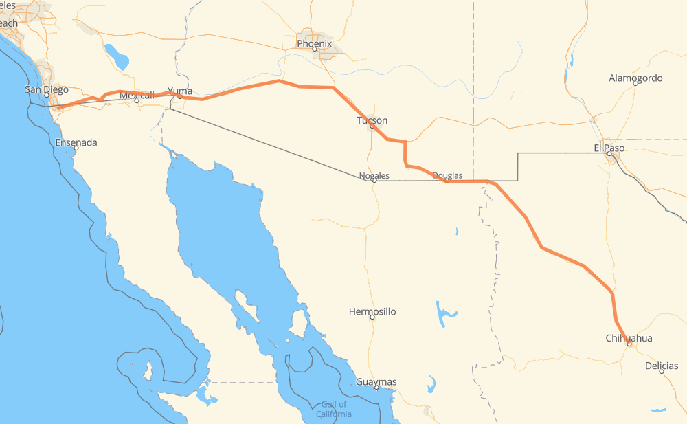
The distance from Tijuana to Chihuahua is 1,354 kilometers by road including 647 kilometers on motorways. Road takes approximately 14 hours and 21 minutes and goes through El Centro, Yuma, Tucson, Agua Prieta and Nuevo Casas Grandes.
| Shortest distance by air | 1,126 km ✈️ |
| Car route length | 1,354 km 🚗 |
| Driving time | 14 h 21 min |
| Fuel amount | 108.3 L |
| Fuel cost | 195 AUD |
| Toll roads cost | 282 + ? MXN |
| Point | Distance | Time | Fuel | |
| Tijuana | 0 km | 00 min | 0.0 L | |
|
MEX 2D 41 km, 31 min
|
||||
| Tecate | 41 km | 31 min | 3.1 L | |
|
CA 188 I 8 125 km, 1 h 17 min
|
||||
| El Centro | 166 km | 1 h 49 min | 13.0 L | |
|
I 8 87 km, 47 min
|
||||
| Yuma | 254 km | 2 h 37 min | 19.8 L | |
|
I 8 25 km, 14 min
|
||||
| Fortuna Foothills | 279 km | 2 h 51 min | 21.9 L | |
|
I 8 23 km, 13 min
|
||||
| Wellton | 302 km | 3 h 05 min | 23.7 L | |
|
I 8 348 km, 3 h 12 min
|
||||
| Tucson | 650 km | 6 h 17 min | 50.1 L | |
|
I 10 AZ 90 192 km, 2 h 08 min
|
||||
| Agua Prieta | 842 km | 8 h 26 min | 67.2 L | |
|
MEX 2 221 km, 2 h 35 min
|
||||
| Nuevo Casas Grandes | 1,063 km | 11 h 02 min | 84.5 L | |
|
MEX 10 MEX 45 291 km, 3 h 19 min
|
||||
| Chihuahua | 1,354 km | 14 h 21 min | 107.8 L | |
Hotels of Chihuahua
Frequently Asked Questions
How many toll booths are there from Tijuana to Chihuahua?
There are 4 toll booths between Tijuana and Chihuahua: Tijuana-Tecate, Galeana, Ojo Laguna and Sacramento.
How much does the toll booths cost from Tijuana to Chihuahua?
Toll roads cost: Tijuana-Tecate (?) + Galeana (115 MXN) + Ojo Laguna (96 MXN) + Sacramento (71 MXN) = 282 + ? MXN
How much does it cost to drive from Tijuana to Chihuahua?
Fuel cost: 195 AUD
This fuel cost is calculated as: (Route length 1,354 km / 100 km) * (Fuel consumption 8 L/100 km) * (Fuel price 1.8 AUD / L)
You can adjust fuel consumption and fuel price here.
Toll roads cost: 282 + ? MXN
How long is a car ride from Tijuana to Chihuahua?
Driving time: 14 h 21 min
This time is calculated for driving at the maximum permitted speed, taking into account traffic rules restrictions.
- 502 km with a maximum speed 110 km/h = 4 h 33 min
- 81 km with a maximum speed 105 km/h = 46 min
- 11 km with a maximum speed 100 km/h = 6 min
- 515 km with a maximum speed 90 km/h = 5 h 43 min
- 16 km with a maximum speed 89 km/h = 11 min
- 205 km with a maximum speed 80 km/h = 2 h 33 min
- 6 km with a maximum speed 72 km/h = 4 min
- 2 km with a maximum speed 70 km/h = 2 min
- 7 km with a maximum speed 60 km/h = 6 min
- 3 km with a maximum speed 50 km/h = 4 min
- 2 km with a maximum speed 48 km/h = 2 min
The calculated driving time does not take into account intermediate stops and traffic jams.
How far is Tijuana to Chihuahua by land?
The distance between Tijuana and Chihuahua is 1,354 km by road including 647 km on motorways.
Precise satellite coordinates of highways were used for this calculation. The start and finish points are the centers of Tijuana and Chihuahua respectively.
How far is Tijuana to Chihuahua by plane?
The shortest distance (air line, as the crow flies) between Tijuana and Chihuahua is 1,126 km.
This distance is calculated using the Haversine formula as a great-circle distance between two points on the surface of a sphere. The start and finish points are the centers of Tijuana and Chihuahua respectively. Actual distance between airports may be different.
How many hours is Tijuana from Chihuahua by plane?
Boeing 737 airliner needs 1 h 24 min to cover the distance of 1,126 km at a cruising speed of 800 km/h.
Small plane "Cessna 172" needs 5 h 7 min to flight this distance at average speed of 220 km/h.
This time is approximate and do not take into account takeoff and landing times, airport location and other real world factors.
How long is a helicopter ride from Tijuana to Chihuahua?
Fast helicopter "Eurocopter AS350" or "Hughes OH-6 Cayuse" need 4 h 41 min to cover the distance of 1,126 km at a cruising speed of 240 km/h.
Popular "Robinson R44" needs 5 h 21 min to flight this distance at average speed of 210 km/h.
This time is approximate and do not take into account takeoff and landing times, aerodrome location and other real world factors.
What city is halfway between Tijuana and Chihuahua?
The halfway point between Tijuana and Chihuahua is Mountain View.
The distance from Mountain View to Tijuana is 677 km and driving will take about 6 h 35 min. The road between Mountain View and Chihuahua has length 676 km and will take approximately 7 h 46 min.
The other cities located close to halfway point:
Where is Tijuana in relation to Chihuahua?
Tijuana is located 1,126 km north-west of Chihuahua.
Tijuana has geographic coordinates: latitude 32.50086, longitude -116.96417.
Chihuahua has geographic coordinates: latitude 28.66057, longitude -106.07498.
Which highway goes from Tijuana to Chihuahua?
The route from Tijuana to Chihuahua follows I 8, MEX 2, I 10, MEX 10.
Other minor sections pass along the road:
- MEX 45: 87 km
- CHIH 7: 76 km
- AZ 90: 75 km
- CHIH 56D: 61 km
- AZ 80: 51 km
- CA 94: 42 km
- MEX 2D: 27 km
- MEX 45D: 13 km
- CA 188: 3 km
- SR 80: 2 km
- US 191 Bus: 2 km
- CHIH 4: 2 km