Distance between Tijuana and Mexico City
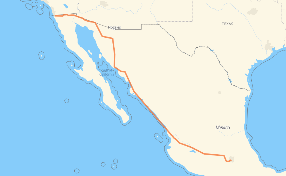
The distance from Tijuana to Mexico City is 2,747 kilometers by road including 2,210 kilometers on motorways. Road takes approximately 30 hours and 35 minutes and goes through San Luis Rio Colorado, Heroica Caborca, Hermosillo, Navojoa, Los Mochis, Gabriel Leyva Solano and Dimas (Estación Dimas).
| Shortest distance by air | 2,294 km ✈️ |
| Car route length | 2,747 km 🚗 |
| Driving time | 30 h 35 min |
| Fuel amount | 219.8 L |
| Fuel cost | 395.6 AUD |
| Toll roads cost | 2,426 + ? MXN |
| Point | Distance | Time | Fuel | |
| Tijuana | 0 km | 00 min | 0.0 L | |
|
MEX 2D 239 km, 2 h 49 min
|
||||
| San Luis Rio Colorado | 239 km | 2 h 49 min | 18.9 L | |
|
MEX 2 352 km, 4 h 07 min
|
||||
| Heroica Caborca | 591 km | 6 h 56 min | 46.7 L | |
|
MEX 2 MEX 15D 271 km, 2 h 48 min
|
||||
| Hermosillo | 862 km | 9 h 45 min | 68.8 L | |
|
MEX 15 MEX 15D 323 km, 3 h 29 min
|
||||
| Navojoa | 1,185 km | 13 h 14 min | 94.4 L | |
|
MEX 15D 159 km, 1 h 55 min
|
||||
| Los Mochis | 1,344 km | 15 h 09 min | 107.3 L | |
|
MEX 15D 44 km, 31 min
|
||||
| Gabriel Leyva Solano | 1,388 km | 15 h 41 min | 110.1 L | |
|
MEX 15D 289 km, 3 h 09 min
|
||||
| Dimas (Estación Dimas) | 1,677 km | 18 h 51 min | 133.1 L | |
|
MEX 15D 334 km, 3 h 38 min
|
||||
| Tepic | 2,011 km | 22 h 30 min | 160.2 L | |
|
MEX 15D 222 km, 2 h 16 min
|
||||
| Tonalá | 2,232 km | 24 h 47 min | 178.0 L | |
|
MEX 15D 452 km, 5 h 01 min
|
||||
| Toluca | 2,684 km | 29 h 48 min | 214.5 L | |
|
MEX 15 MEX 15D 63 km, 46 min
|
||||
| Mexico City | 2,747 km | 30 h 34 min | 219.5 L | |
Hotels of Mexico City
Frequently Asked Questions
How many toll booths are there from Tijuana to Mexico City?
There are 35 toll booths between Tijuana and Mexico City: Tijuana-Tecate, El Hongo, La Rumorosa, Mexicali Omega, San Luis Rio Colorado, Santa Ana, Hermosillo, Guaymas, Libramiento Cd Obregon, Fundicion, Estacion Don La Jaula, San Miguel, Sinaloa, Las Brisas, San Pedro km 197+100, Costa Rica, Marmol, El Rosario, Ruiz, Trapichillo, Santa Maria del Oro, Plan de Barrancas, La Joya, Ocotlán, Zinapecuaro, Contepec, Panindicuaro, Ecuandureo, El Dorado, Libramiento la Marquesa, Atlacomulco — Maravatio, Atlacomulco, La Venta, Arenal and El Pisal.
How much does the toll booths cost from Tijuana to Mexico City?
Toll roads cost: Tijuana-Tecate (?) + El Hongo (84 MXN) + La Rumorosa (26 MXN) + Mexicali Omega (?) + San Luis Rio Colorado (?) + Santa Ana (120 MXN) + Hermosillo (90 MXN) + Guaymas (38 MXN) + Libramiento Cd Obregon (?) + Fundicion (90 MXN) + Estacion Don La Jaula (90 MXN) + San Miguel (69 MXN) + Sinaloa (24 MXN) + Las Brisas (76 MXN) + El Pisal (73 MXN) + San Pedro km 197+100 (34 MXN) + Costa Rica (152 MXN) + Marmol (131 MXN) + El Rosario (140 MXN) + Ruiz (120 MXN) + Trapichillo (80 MXN) + Santa Maria del Oro (115 MXN) + Plan de Barrancas (195 MXN) + Arenal (131 MXN) + La Joya (?) + Ocotlán (226 MXN) + Ecuandureo (111 MXN) + Panindicuaro (?) + Zinapecuaro (161 MXN) + Contepec (?) + Atlacomulco — Maravatio (50 MXN) + Atlacomulco (?) + El Dorado (?) + Libramiento la Marquesa (?) + La Venta (?) = 2,426 + ? MXN
How much does it cost to drive from Tijuana to Mexico City?
Fuel cost: 395.6 AUD
This fuel cost is calculated as: (Route length 2,747 km / 100 km) * (Fuel consumption 8 L/100 km) * (Fuel price 1.8 AUD / L)
You can adjust fuel consumption and fuel price here.
Toll roads cost: 2,426 + ? MXN
How long is a car ride from Tijuana to Mexico City?
Driving time: 30 h 35 min
This time is calculated for driving at the maximum permitted speed, taking into account traffic rules restrictions.
- 437 km with a maximum speed 110 km/h = 3 h 58 min
- 843 km with a maximum speed 100 km/h = 8 h 26 min
- 433 km with a maximum speed 90 km/h = 4 h 48 min
- 950 km with a maximum speed 80 km/h = 11 h 52 min
- 12 km with a maximum speed 70 km/h = 10 min
- 63 km with a maximum speed 60 km/h = 1 h 2 min
- 5 km with a maximum speed 50 km/h = 6 min
- 1 km with a maximum speed 40 km/h = 1 min
- 1 km with a maximum speed 20 km/h = 1 min
- 1 km with a maximum speed 10 km/h = 6 min
The calculated driving time does not take into account intermediate stops and traffic jams.
How far is Tijuana to Mexico City by land?
The distance between Tijuana and Mexico City is 2,747 km by road including 2,210 km on motorways.
Precise satellite coordinates of highways were used for this calculation. The start and finish points are the centers of Tijuana and Mexico City respectively.
How far is Tijuana to Mexico City by plane?
The shortest distance (air line, as the crow flies) between Tijuana and Mexico City is 2,294 km.
This distance is calculated using the Haversine formula as a great-circle distance between two points on the surface of a sphere. The start and finish points are the centers of Tijuana and Mexico City respectively. Actual distance between airports may be different.
How many hours is Tijuana from Mexico City by plane?
Boeing 737 airliner needs 2 h 52 min to cover the distance of 2,294 km at a cruising speed of 800 km/h.
Small plane "Cessna 172" needs 10 h 25 min to flight this distance at average speed of 220 km/h.
This time is approximate and do not take into account takeoff and landing times, airport location and other real world factors.
How long is a helicopter ride from Tijuana to Mexico City?
Fast helicopter "Eurocopter AS350" or "Hughes OH-6 Cayuse" need 9 h 33 min to cover the distance of 2,294 km at a cruising speed of 240 km/h.
Popular "Robinson R44" needs 10 h 55 min to flight this distance at average speed of 210 km/h.
This time is approximate and do not take into account takeoff and landing times, aerodrome location and other real world factors.
What city is halfway between Tijuana and Mexico City?
The halfway point between Tijuana and Mexico City is Adolfo Ruiz Cortines. It is located about 3 km from the exact midpoint by road.
The distance from Adolfo Ruiz Cortines to Tijuana is 1,371 km and driving will take about 15 h 26 min. The road between Adolfo Ruiz Cortines and Mexico City has length 1,376 km and will take approximately 15 h 8 min.
The other cities located close to halfway point:
Where is Tijuana in relation to Mexico City?
Tijuana is located 2,294 km north-west of Mexico City.
Tijuana has geographic coordinates: latitude 32.50086, longitude -116.96417.
Mexico City has geographic coordinates: latitude 19.4326, longitude -99.13334.
Which highway goes from Tijuana to Mexico City?
The route from Tijuana to Mexico City follows MEX 15D, MEX 2, MEX 2D.
Other minor sections pass along the road:
- MEX 15: 51 km
- MEX 55D: 47 km
- MEX 70: 31 km
- MEX 90: 31 km
- MEX 80D: 18 km
- MEX 55: 14 km
- MEX 80: 11 km
- MEX15D: 10 km
- MEX 23: 8 km
- 1S: 4 km
- MEX 15d: 3 km
- Eje Central: 1 km