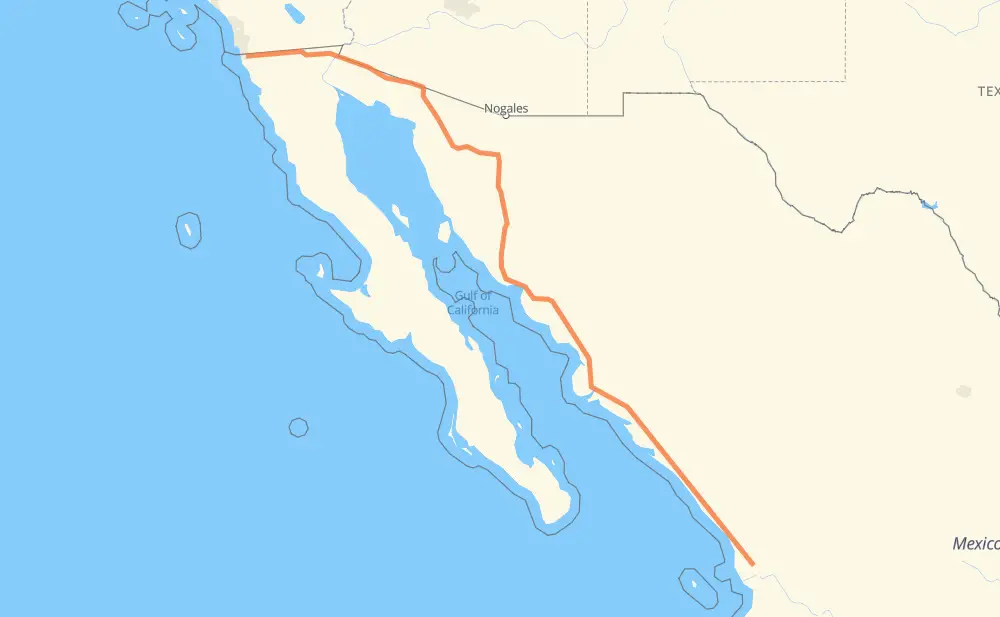
The distance from Tijuana to Paso real del bejuco is 1,946 kilometers by road including 1,436 kilometers on motorways. Road takes approximately 21 hours and 50 minutes and goes through San Luis Rio Colorado, Heroica Caborca, Hermosillo, Navojoa, Los Mochis, Gabriel Leyva Solano and Dimas (Estación Dimas).
How much does it cost to drive from Tijuana to Paso real del bejuco?
Fuel cost:
277.1 AUD
This fuel cost is calculated as: (Route length 1,946 km / 100 km) * (Fuel consumption 8 L/100 km) * (Fuel price 1.78 AUD / L)
You can adjust fuel consumption and fuel price here.
Toll roads cost:
1,237 + ? MXN
How long is a car ride from Tijuana to Paso real del bejuco?
Driving time:
21 h 50 min
This time is calculated for driving at the maximum permitted speed, taking into account traffic rules restrictions.
285 km with a maximum speed 110 km/h = 2 h 35 min
526 km with a maximum speed 100 km/h = 5 h 15 min
414 km with a maximum speed 90 km/h = 4 h 35 min
661 km with a maximum speed 80 km/h = 8 h 15 min
52 km with a maximum speed 60 km/h = 51 min
7 km with a maximum speed 50 km/h = 8 min
1 km with a maximum speed 40 km/h = 1 min
1 km with a maximum speed 20 km/h = 1 min
1 km with a maximum speed 10 km/h = 6 min
The calculated driving time does not take into account intermediate stops and traffic jams.
How far is Tijuana to Paso real del bejuco by land?
The distance between Tijuana and Paso real del bejuco is 1,946 km by road including 1,436 km on motorways.
Precise satellite coordinates of highways were used for this calculation. The start and finish points are the centers of Tijuana and Paso real del bejuco respectively.
How far is Tijuana to Paso real del bejuco by plane?
The shortest distance (air line, as the crow flies) between Tijuana and Paso real del bejuco is 1,645 km.
This distance is calculated using the Haversine formula as a great-circle distance between two points on the surface of a sphere. The start and finish points are the centers of Tijuana and Paso real del bejuco respectively. Actual distance between airports may be different.
How many hours is Tijuana from Paso real del bejuco by plane?
Boeing 737 airliner needs 2 h 3 min to cover the distance of 1,645 km at a cruising speed of 800 km/h.
Small plane "Cessna 172" needs 7 h 28 min to flight this distance at average speed of 220 km/h.
This time is approximate and do not take into account takeoff and landing times, airport location and other real world factors.
How long is a helicopter ride from Tijuana to Paso real del bejuco?
Fast helicopter "Eurocopter AS350" or "Hughes OH-6 Cayuse" need 6 h 51 min to cover the distance of 1,645 km at a cruising speed of 240 km/h.
Popular "Robinson R44" needs 7 h 50 min to flight this distance at average speed of 210 km/h.
This time is approximate and do not take into account takeoff and landing times, aerodrome location and other real world factors.
What city is halfway between Tijuana and Paso real del bejuco?
The halfway point between Tijuana and Paso real del bejuco is Campamento el Tigre. It is located about 5 km from the exact midpoint by road.
The distance from Campamento el Tigre to Tijuana is 978 km and driving will take about 10 h 52 min. The road between Campamento el Tigre and Paso real del bejuco has length 968 km and will take approximately 10 h 58 min.
The other cities located close to halfway point:
El Caballo (Gral. Adolfo de la H. No. 1) is in 982 km from Tijuana and 964 km from Paso real del bejuco
San Emeterio is in 964 km from Tijuana and 982 km from Paso real del bejuco
El Caballito (Rancho Nuevo) is in 984 km from Tijuana and 962 km from Paso real del bejuco
Where is Tijuana in relation to Paso real del bejuco?
Tijuana is located 1,645 km north-west of Paso real del bejuco.
Tijuana has geographic coordinates: latitude 32.50086, longitude -116.96417.
Paso real del bejuco has geographic coordinates: latitude 22.01891, longitude -105.1868.
Which highway goes from Tijuana to Paso real del bejuco?
The route from Tijuana to Paso real del bejuco follows MEX 15D, MEX 2, MEX 2D.