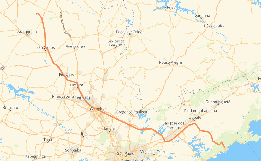
Distance between Ubatuba and Guatapará
The distance from Ubatuba to Guatapará is 493 kilometers by road including 345 kilometers on motorways. Road takes approximately 5 hours and 3 minutes and goes through Jacareí, Atibaia, Itatiba and Rio Claro.
| Shortest distance by air | 372 km ✈️ |
| Car route length | 493 km 🚗 |
| Driving time | 5 h 3 min |
| Fuel amount | 39.5 L |
| Fuel cost | 71 AUD |
| Point | Distance | Time | Fuel | |
| -23.43316, -45.08342 | 0 km | 00 min | 0.0 L | |
|
SP-125 131 km, 1 h 24 min
|
||||
| Parque Interlagos | 131 km | 1 h 24 min | 20.6 L | |
|
SP-070 12 km, 07 min
|
||||
| Jacareí | 144 km | 1 h 31 min | 21.6 L | |
|
SP-070 SP-065 60 km, 33 min
|
||||
| Nazaré Paulista | 203 km | 2 h 05 min | 26.2 L | |
|
SP-065 9 km, 05 min
|
||||
| Bom Jesus dos Perdões | 213 km | 2 h 10 min | 27.1 L | |
|
SP-065 16 km, 09 min
|
||||
| Atibaia | 229 km | 2 h 19 min | 27.6 L | |
|
SP-065 26 km, 14 min
|
||||
| Itatiba | 255 km | 2 h 34 min | 30.3 L | |
|
SP-065 40 km, 22 min
|
||||
| San Martin | 295 km | 2 h 56 min | 33.6 L | |
|
SP-065 SP-330 73 km, 45 min
|
||||
| Rio Claro | 369 km | 3 h 41 min | 39.4 L | |
|
SP-310 58 km, 35 min
|
||||
| Jardim Itamaraty | 427 km | 4 h 17 min | 44.4 L | |
|
SP-310 SP-318 67 km, 46 min
|
||||
| Guatapará | 493 km | 5 h 03 min | 49.4 L | |
Frequently Asked Questions
How much does it cost to drive from Ubatuba to Guatapará?
Fuel cost: 71 AUD
This fuel cost is calculated as: (Route length 493 km / 100 km) * (Fuel consumption 8 L/100 km) * (Fuel price 1.8 AUD / L)
You can adjust fuel consumption and fuel price here.
How long is a car ride from Ubatuba to Guatapará?
Driving time: 5 h 3 min
This time is calculated for driving at the maximum permitted speed, taking into account traffic rules restrictions.
- 224 km with a maximum speed 110 km/h = 2 h 2 min
- 92 km with a maximum speed 100 km/h = 55 min
- 133 km with a maximum speed 90 km/h = 1 h 28 min
- 38 km with a maximum speed 80 km/h = 28 min
- 6 km with a maximum speed 40 km/h = 8 min
The calculated driving time does not take into account intermediate stops and traffic jams.
How far is Ubatuba to Guatapará by land?
The distance between Ubatuba and Guatapará is 493 km by road including 345 km on motorways.
Precise satellite coordinates of highways were used for this calculation. The start and finish points are the centers of Ubatuba and Guatapará respectively.
How far is Ubatuba to Guatapará by plane?
The shortest distance (air line, as the crow flies) between Ubatuba and Guatapará is 372 km.
This distance is calculated using the Haversine formula as a great-circle distance between two points on the surface of a sphere. The start and finish points are the centers of Ubatuba and Guatapará respectively. Actual distance between airports may be different.
How many hours is Ubatuba from Guatapará by plane?
Boeing 737 airliner needs 27 min to cover the distance of 372 km at a cruising speed of 800 km/h.
Small plane "Cessna 172" needs 1 h 41 min to flight this distance at average speed of 220 km/h.
This time is approximate and do not take into account takeoff and landing times, airport location and other real world factors.
How long is a helicopter ride from Ubatuba to Guatapará?
Fast helicopter "Eurocopter AS350" or "Hughes OH-6 Cayuse" need 1 h 33 min to cover the distance of 372 km at a cruising speed of 240 km/h.
Popular "Robinson R44" needs 1 h 46 min to flight this distance at average speed of 210 km/h.
This time is approximate and do not take into account takeoff and landing times, aerodrome location and other real world factors.
What city is halfway between Ubatuba and Guatapará?
The halfway point between Ubatuba and Guatapará is Itatiba. It is located about 9 km from the exact midpoint by road.
The distance from Itatiba to Ubatuba is 255 km and driving will take about 2 h 34 min. The road between Itatiba and Guatapará has length 238 km and will take approximately 2 h 29 min.
The other cities located close to halfway point:
Where is Ubatuba in relation to Guatapará?
Ubatuba is located 372 km south-east of Guatapará.
Ubatuba has geographic coordinates: latitude -23.43316, longitude -45.08342.
Guatapará has geographic coordinates: latitude -21.49609, longitude -48.03607.
Which highway goes from Ubatuba to Guatapará?
The route from Ubatuba to Guatapará follows SP-065.
Other minor sections pass along the road:
- SP-125: 88 km
- BR-383: 88 km
- BR-364: 83 km
- SP-310: 82 km
- SP-070: 59 km
- SP-330: 49 km
- BR-050: 49 km
- SP-318: 45 km
- BR-267: 7 km
- SP-255: 4 km