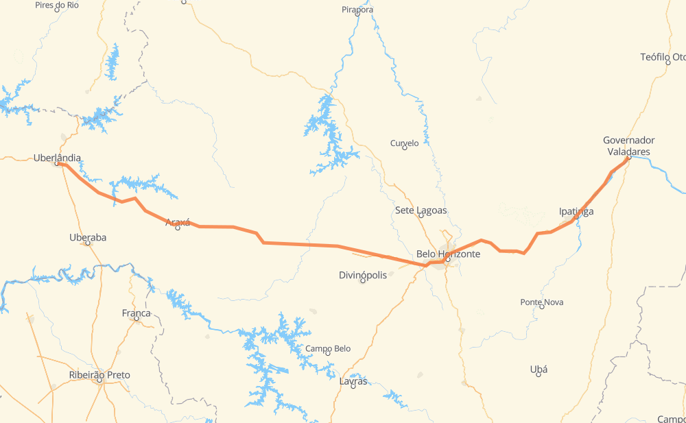
Distance between Uberlândia and Governador Valadares
The distance from Uberlândia to Governador Valadares is 851 kilometers by road including 129 kilometers on motorways. Road takes approximately 10 hours and 16 minutes and goes through Betim, Coronel Fabriciano, Santa Juliana, Condomínio Via Verde, Distrito Industrial, Luz and Nova Serrana.
| Shortest distance by air | 666 km ✈️ |
| Car route length | 851 km 🚗 |
| Driving time | 10 h 16 min |
| Fuel amount | 68.1 L |
| Fuel cost | 123.2 AUD |
| Point | Distance | Time | Fuel | |
| Uberlândia | 0 km | 00 min | 0.0 L | |
|
BR-452 94 km, 1 h 05 min
|
||||
| Santa Juliana | 94 km | 1 h 05 min | 6.8 L | |
|
BR-452 73 km, 51 min
|
||||
| Condomínio Via Verde | 167 km | 1 h 57 min | 13.2 L | |
|
BR-452 4 km, 02 min
|
||||
| Distrito Industrial | 171 km | 2 h 00 min | 13.6 L | |
|
BR-452 BR-262 158 km, 1 h 51 min
|
||||
| Luz | 329 km | 3 h 52 min | 25.5 L | |
|
BR-262 88 km, 1 h 08 min
|
||||
| Nova Serrana | 418 km | 5 h 01 min | 33.0 L | |
|
BR-262 42 km, 23 min
|
||||
| Pará de Minas | 460 km | 5 h 24 min | 36.4 L | |
|
BR-262 47 km, 29 min
|
||||
| Betim | 507 km | 5 h 53 min | 40.1 L | |
|
BR-262 BR-381 231 km, 2 h 58 min
|
||||
| Coronel Fabriciano | 738 km | 8 h 52 min | 58.8 L | |
|
BR-381 115 km, 1 h 24 min
|
||||
| Governador Valadares | 853 km | 10 h 16 min | 68.2 L | |
Hotels of Governador Valadares
Frequently Asked Questions
How much does it cost to drive from Uberlândia to Governador Valadares?
Fuel cost: 123.2 AUD
This fuel cost is calculated as: (Route length 851 km / 100 km) * (Fuel consumption 8 L/100 km) * (Fuel price 1.81 AUD / L)
You can adjust fuel consumption and fuel price here.
How long is a car ride from Uberlândia to Governador Valadares?
Driving time: 10 h 16 min
This time is calculated for driving at the maximum permitted speed, taking into account traffic rules restrictions.
- 81 km with a maximum speed 110 km/h = 44 min
- 15 km with a maximum speed 100 km/h = 9 min
- 357 km with a maximum speed 90 km/h = 3 h 57 min
- 307 km with a maximum speed 80 km/h = 3 h 50 min
- 5 km with a maximum speed 70 km/h = 4 min
- 81 km with a maximum speed 60 km/h = 1 h 20 min
- 1 km with a maximum speed 50 km/h = 1 min
- 5 km with a maximum speed 40 km/h = 8 min
The calculated driving time does not take into account intermediate stops and traffic jams.
How far is Uberlândia to Governador Valadares by land?
The distance between Uberlândia and Governador Valadares is 851 km by road including 129 km on motorways.
Precise satellite coordinates of highways were used for this calculation. The start and finish points are the centers of Uberlândia and Governador Valadares respectively.
How far is Uberlândia to Governador Valadares by plane?
The shortest distance (air line, as the crow flies) between Uberlândia and Governador Valadares is 666 km.
This distance is calculated using the Haversine formula as a great-circle distance between two points on the surface of a sphere. The start and finish points are the centers of Uberlândia and Governador Valadares respectively. Actual distance between airports may be different.
How many hours is Uberlândia from Governador Valadares by plane?
Boeing 737 airliner needs 49 min to cover the distance of 666 km at a cruising speed of 800 km/h.
Small plane "Cessna 172" needs 3 h 1 min to flight this distance at average speed of 220 km/h.
This time is approximate and do not take into account takeoff and landing times, airport location and other real world factors.
How long is a helicopter ride from Uberlândia to Governador Valadares?
Fast helicopter "Eurocopter AS350" or "Hughes OH-6 Cayuse" need 2 h 46 min to cover the distance of 666 km at a cruising speed of 240 km/h.
Popular "Robinson R44" needs 3 h 10 min to flight this distance at average speed of 210 km/h.
This time is approximate and do not take into account takeoff and landing times, aerodrome location and other real world factors.
What city is halfway between Uberlândia and Governador Valadares?
The halfway point between Uberlândia and Governador Valadares is Nova Serrana. It is located about 8 km from the exact midpoint by road.
The distance from Nova Serrana to Uberlândia is 418 km and driving will take about 5 h. The road between Nova Serrana and Governador Valadares has length 433 km and will take approximately 5 h 15 min.
The other cities located close to halfway point:
Where is Uberlândia in relation to Governador Valadares?
Uberlândia is located 666 km west of Governador Valadares.
Uberlândia has geographic coordinates: latitude -18.9188, longitude -48.27678.
Governador Valadares has geographic coordinates: latitude -18.85395, longitude -41.94588.
Which highway goes from Uberlândia to Governador Valadares?
The route from Uberlândia to Governador Valadares follows BR-262, BR-381, BR-452.
Other minor sections pass along the road:
- BR-354: 12 km
- BR-040: 3 km
- BR-365: 2 km
- MG-129: 1 km