Distance between Uruaçu and Pouso Redondo
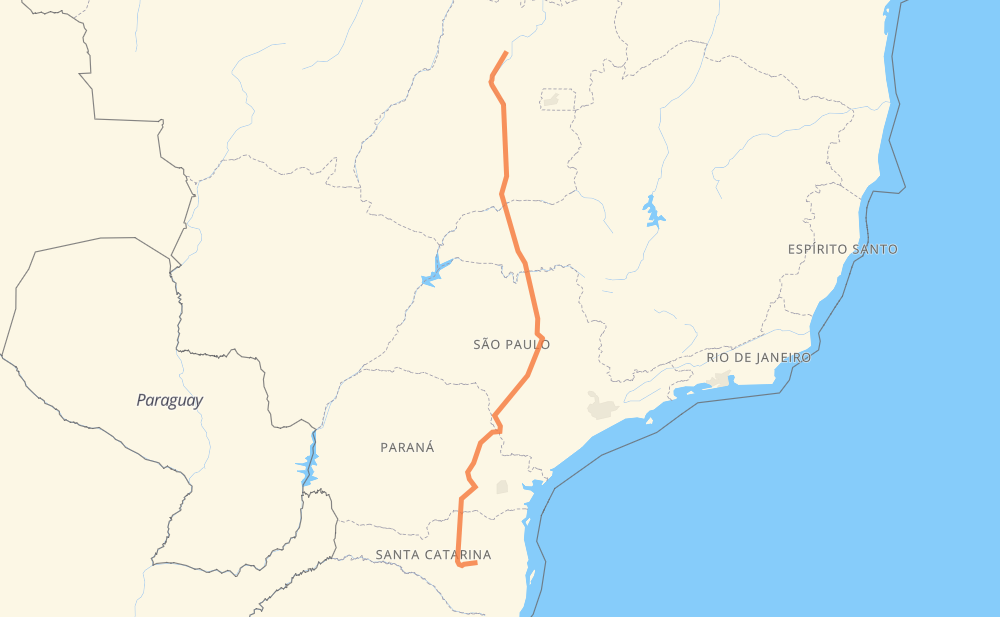
The distance from Uruaçu to Pouso Redondo is 1,791 kilometers by road including 430 kilometers on motorways. Road takes approximately 20 hours and 19 minutes and goes through Goiânia, Chácara Bom Retiro, Granjas Reunidas Nossa Senhora de Lourdes, Centralina, Prata, Planura and Jardim Salto Grande I.
| Shortest distance by air | 1,418 km ✈️ |
| Car route length | 1,791 km 🚗 |
| Driving time | 20 h 19 min |
| Fuel amount | 143.3 L |
| Fuel cost | 258 AUD |
| Point | Distance | Time | Fuel | |
| -14.52442, -49.15100 | 0 km | 00 min | 0.0 L | |
|
BR-153 257 km, 3 h 01 min
|
||||
| Chácara Bom Retiro | 257 km | 3 h 01 min | 39.3 L | |
|
GO-080 21 km, 15 min
|
||||
| Goiânia | 278 km | 3 h 17 min | 41.7 L | |
|
BR-153 8 km, 05 min
|
||||
| Granjas Reunidas Nossa Senhora de Lourdes | 285 km | 3 h 22 min | 42.3 L | |
|
BR-153 226 km, 2 h 15 min
|
||||
| Centralina | 511 km | 5 h 37 min | 59.7 L | |
|
BR-153 82 km, 50 min
|
||||
| Prata | 593 km | 6 h 28 min | 66.5 L | |
|
BR-153 113 km, 1 h 16 min
|
||||
| Planura | 705 km | 7 h 44 min | 75.8 L | |
|
BR-364 SP-326 199 km, 2 h 00 min
|
||||
| Jardim Salto Grande I | 905 km | 9 h 45 min | 91.9 L | |
|
SPI 274/310 SP-255 235 km, 2 h 39 min
|
||||
| Jardim Ouro Branco | 1,139 km | 12 h 24 min | 110.7 L | |
|
SP-255 35 km, 24 min
|
||||
| Itaporanga | 1,174 km | 12 h 49 min | 112.3 L | |
|
SP-255 PR-151 621 km, 7 h 30 min
|
||||
| Pouso Redondo | 1,795 km | 20 h 19 min | 162.9 L | |
Frequently Asked Questions
How much does it cost to drive from Uruaçu to Pouso Redondo?
Fuel cost: 258 AUD
This fuel cost is calculated as: (Route length 1,791 km / 100 km) * (Fuel consumption 8 L/100 km) * (Fuel price 1.8 AUD / L)
You can adjust fuel consumption and fuel price here.
How long is a car ride from Uruaçu to Pouso Redondo?
Driving time: 20 h 19 min
This time is calculated for driving at the maximum permitted speed, taking into account traffic rules restrictions.
- 297 km with a maximum speed 110 km/h = 2 h 42 min
- 74 km with a maximum speed 100 km/h = 44 min
- 803 km with a maximum speed 90 km/h = 8 h 55 min
- 598 km with a maximum speed 80 km/h = 7 h 28 min
- 7 km with a maximum speed 60 km/h = 6 min
- 14 km with a maximum speed 40 km/h = 21 min
The calculated driving time does not take into account intermediate stops and traffic jams.
How far is Uruaçu to Pouso Redondo by land?
The distance between Uruaçu and Pouso Redondo is 1,791 km by road including 430 km on motorways.
Precise satellite coordinates of highways were used for this calculation. The start and finish points are the centers of Uruaçu and Pouso Redondo respectively.
How far is Uruaçu to Pouso Redondo by plane?
The shortest distance (air line, as the crow flies) between Uruaçu and Pouso Redondo is 1,418 km.
This distance is calculated using the Haversine formula as a great-circle distance between two points on the surface of a sphere. The start and finish points are the centers of Uruaçu and Pouso Redondo respectively. Actual distance between airports may be different.
How many hours is Uruaçu from Pouso Redondo by plane?
Boeing 737 airliner needs 1 h 46 min to cover the distance of 1,418 km at a cruising speed of 800 km/h.
Small plane "Cessna 172" needs 6 h 26 min to flight this distance at average speed of 220 km/h.
This time is approximate and do not take into account takeoff and landing times, airport location and other real world factors.
How long is a helicopter ride from Uruaçu to Pouso Redondo?
Fast helicopter "Eurocopter AS350" or "Hughes OH-6 Cayuse" need 5 h 54 min to cover the distance of 1,418 km at a cruising speed of 240 km/h.
Popular "Robinson R44" needs 6 h 45 min to flight this distance at average speed of 210 km/h.
This time is approximate and do not take into account takeoff and landing times, aerodrome location and other real world factors.
What city is halfway between Uruaçu and Pouso Redondo?
The halfway point between Uruaçu and Pouso Redondo is Jardim Salto Grande I. It is located about 9 km from the exact midpoint by road.
The distance from Jardim Salto Grande I to Uruaçu is 905 km and driving will take about 9 h 45 min. The road between Jardim Salto Grande I and Pouso Redondo has length 887 km and will take approximately 10 h 34 min.
The other cities located close to halfway point:
Where is Uruaçu in relation to Pouso Redondo?
Uruaçu is located 1,418 km north of Pouso Redondo.
Uruaçu has geographic coordinates: latitude -14.52442, longitude -49.151.
Pouso Redondo has geographic coordinates: latitude -27.25674, longitude -49.93316.
Which highway goes from Uruaçu to Pouso Redondo?
The route from Uruaçu to Pouso Redondo follows BR-153, PR-151, SP-255, SP-326, BR-116, GO-080, BR-364.
Other minor sections pass along the road:
- BR-272: 69 km
- BR-470: 59 km
- SP-281: 54 km
- SC-477: 34 km
- BR-455: 30 km
- LMG-810: 24 km
- SP-310: 18 km
- BR-262: 13 km
- BR-267: 12 km
- PR-239: 12 km
- BR-280: 11 km
- BR-376: 10 km
- SC-120: 9 km
- PRC-373: 8 km
- BR-369: 6 km
- PR 151: 3 km
- MGC-455: 3 km
- SP-304: 2 km
- BR-476: 2 km
- SPI 274/310: 2 km