Distance between Villa Víl and Anita
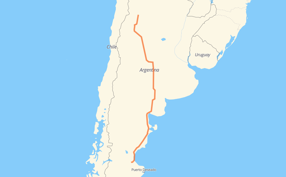
The distance from Villa Víl to Anita is 2,660 kilometers by road. Road takes approximately 30 hours and 45 minutes and goes through Santa Rosa, Comodoro Rivadavia, Caleta Olivia, La Puerta de San José, Belén, Chilecito and Nonogasta.
| Shortest distance by air | 2,181 km ✈️ |
| Car route length | 2,660 km 🚗 |
| Driving time | 30 h 45 min |
| Fuel amount | 212.8 L |
| Fuel cost | 383.1 AUD |
| Point | Distance | Time | Fuel | |
| Villa Víl | 0 km | 00 min | 0.0 L | |
|
RP43 RN40 61 km, 51 min
|
||||
| La Puerta de San José | 61 km | 51 min | 4.6 L | |
|
RN40 11 km, 08 min
|
||||
| Belén | 71 km | 59 min | 5.0 L | |
|
RN40 222 km, 2 h 38 min
|
||||
| Chilecito | 294 km | 3 h 37 min | 23.3 L | |
|
RN40 15 km, 11 min
|
||||
| Nonogasta | 308 km | 3 h 48 min | 24.4 L | |
|
RN40 RN74 182 km, 2 h 04 min
|
||||
| Chamical | 490 km | 5 h 53 min | 39.0 L | |
|
RN79 553 km, 6 h 18 min
|
||||
| Vicuña Mackenna | 1,044 km | 12 h 11 min | 82.2 L | |
|
RN35 286 km, 3 h 18 min
|
||||
| Santa Rosa | 1,330 km | 15 h 30 min | 105.9 L | |
|
RN35 RN3 1,198 km, 13 h 33 min
|
||||
| Comodoro Rivadavia | 2,528 km | 29 h 03 min | 202.2 L | |
|
RN3 133 km, 1 h 41 min
|
||||
| Anita | 2,660 km | 30 h 45 min | 212.7 L | |
Frequently Asked Questions
How much does it cost to drive from Villa Víl to Anita?
Fuel cost: 383.1 AUD
This fuel cost is calculated as: (Route length 2,660 km / 100 km) * (Fuel consumption 8 L/100 km) * (Fuel price 1.8 AUD / L)
You can adjust fuel consumption and fuel price here.
How long is a car ride from Villa Víl to Anita?
Driving time: 30 h 45 min
This time is calculated for driving at the maximum permitted speed, taking into account traffic rules restrictions.
- 2,271 km with a maximum speed 90 km/h = 25 h 14 min
- 290 km with a maximum speed 80 km/h = 3 h 37 min
- 56 km with a maximum speed 60 km/h = 56 min
- 31 km with a maximum speed 50 km/h = 37 min
- 9 km with a maximum speed 40 km/h = 13 min
- 2 km with a maximum speed 20 km/h = 4 min
The calculated driving time does not take into account intermediate stops and traffic jams.
How far is Villa Víl to Anita by land?
The distance between Villa Víl and Anita is 2,660 km by road.
Precise satellite coordinates of highways were used for this calculation. The start and finish points are the centers of Villa Víl and Anita respectively.
How far is Villa Víl to Anita by plane?
The shortest distance (air line, as the crow flies) between Villa Víl and Anita is 2,181 km.
This distance is calculated using the Haversine formula as a great-circle distance between two points on the surface of a sphere. The start and finish points are the centers of Villa Víl and Anita respectively. Actual distance between airports may be different.
How many hours is Villa Víl from Anita by plane?
Boeing 737 airliner needs 2 h 43 min to cover the distance of 2,181 km at a cruising speed of 800 km/h.
Small plane "Cessna 172" needs 9 h 54 min to flight this distance at average speed of 220 km/h.
This time is approximate and do not take into account takeoff and landing times, airport location and other real world factors.
How long is a helicopter ride from Villa Víl to Anita?
Fast helicopter "Eurocopter AS350" or "Hughes OH-6 Cayuse" need 9 h 5 min to cover the distance of 2,181 km at a cruising speed of 240 km/h.
Popular "Robinson R44" needs 10 h 23 min to flight this distance at average speed of 210 km/h.
This time is approximate and do not take into account takeoff and landing times, aerodrome location and other real world factors.
What city is halfway between Villa Víl and Anita?
The halfway point between Villa Víl and Anita is Santa Rosa. It is located about 1 km from the exact midpoint by road.
The distance from Santa Rosa to Villa Víl is 1,330 km and driving will take about 15 h 30 min. The road between Santa Rosa and Anita has length 1,331 km and will take approximately 15 h 15 min.
The other cities located close to halfway point:
Where is Villa Víl in relation to Anita?
Villa Víl is located 2,181 km north of Anita.
Villa Víl has geographic coordinates: latitude -27.09385, longitude -66.82256.
Anita has geographic coordinates: latitude -46.67722, longitude -68.04619.
Which highway goes from Villa Víl to Anita?
The route from Villa Víl to Anita follows RN3, RN35, RN40, RN79, RN251, RN154, RN74, RN7, RP2.
Other minor sections pass along the road:
- RP55: 69 km
- RN38: 68 km
- RN22: 32 km
- RP12: 31 km
- RP43: 26 km
- RP36: 25 km
- RN20: 12 km
- RP20: 6 km
- RN60: 5 km