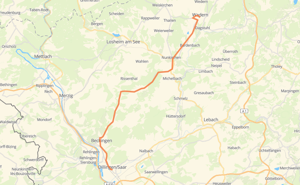
Distance between Wadern and Dillingen/Saar
The distance from Wadern to Dillingen/Saar is 31 kilometers by road. Road takes approximately 31 minutes and goes through Oppen, Haustadt, Pachten, Noswendel, Bardenbach and Nunkirchen.
| Shortest distance by air | 24 km ✈️ |
| Car route length | 31 km 🚗 |
| Driving time | 31 min |
| Fuel amount | 2.5 L |
| Fuel cost | 4.4 AUD |
| Point | Distance | Time | Fuel | |
| 49.54102, 6.88893 | 0 km | 00 min | 0.0 L | |
|
L 151 4 km, 03 min
|
||||
| Noswendel | 4 km | 03 min | 0.5 L | |
|
L 148 2 km, 01 min
|
||||
| Bardenbach | 6 km | 05 min | 0.6 L | |
|
L 148 3 km, 02 min
|
||||
| Nunkirchen | 9 km | 07 min | 0.9 L | |
|
B 268 L 156 7 km, 05 min
|
||||
| Oppen | 16 km | 13 min | 1.5 L | |
|
L 156 7 km, 07 min
|
||||
| Haustadt | 23 km | 21 min | 2.0 L | |
|
L 156 L 347 8 km, 09 min
|
||||
| Pachten | 31 km | 30 min | 2.6 L | |
|
L 174 1 km, 01 min
|
||||
| 49.35527, 6.72432 | 31 km | 31 min | 2.8 L | |
Hotels of Dillingen/Saar
Frequently Asked Questions
How much does it cost to drive from Wadern to Dillingen/Saar?
Fuel cost: 4.4 AUD
This fuel cost is calculated as: (Route length 31 km / 100 km) * (Fuel consumption 8 L/100 km) * (Fuel price 1.76 AUD / L)
You can adjust fuel consumption and fuel price here.
How long is a car ride from Wadern to Dillingen/Saar?
Driving time: 31 min
This time is calculated for driving at the maximum permitted speed, taking into account traffic rules restrictions.
- 10 km with a maximum speed 90 km/h = 6 min
- 4 km with a maximum speed 70 km/h = 3 min
- 15 km with a maximum speed 50 km/h = 18 min
- 1 km with a maximum speed 30 km/h = 2 min
The calculated driving time does not take into account intermediate stops and traffic jams.
How far is Wadern to Dillingen/Saar by land?
The distance between Wadern and Dillingen/Saar is 31 km by road.
Precise satellite coordinates of highways were used for this calculation. The start and finish points are the centers of Wadern and Dillingen/Saar respectively.
What city is halfway between Wadern and Dillingen/Saar?
Where is Wadern in relation to Dillingen/Saar?
Wadern is located 24 km north-east of Dillingen/Saar.
Wadern has geographic coordinates: latitude 49.54102, longitude 6.88893.
Dillingen/Saar has geographic coordinates: latitude 49.35527, longitude 6.72432.
Which highway goes from Wadern to Dillingen/Saar?
The route from Wadern to Dillingen/Saar follows L 156.
Other minor sections pass along the road:
- L 148: 6 km
- L 347: 4 km
- L 151: 2 km
- B 268: 2 km
- L 174: 1 km
- L 366: 1 km