Distance between Ware TX and Calgary AB
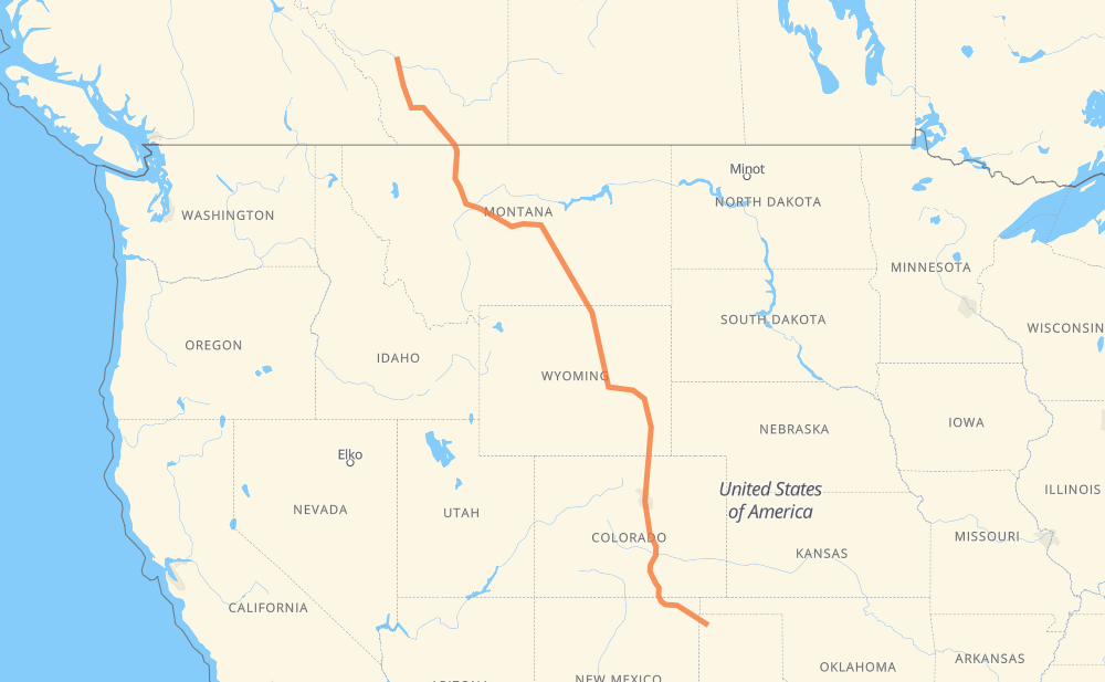
The distance from Ware to Calgary is 2,300 kilometers by road including 1,494 kilometers on motorways. Road takes approximately 23 hours and 49 minutes and goes through Pueblo, Colorado Springs, Denver, Cheyenne, Casper, Sheridan and Billings.
| Shortest distance by air | 1,885 km ✈️ |
| Car route length | 2,300 km 🚗 |
| Driving time | 23 h 49 min |
| Fuel amount | 184 L |
| Fuel cost | 329.3 AUD |
| Point | Distance | Time | Fuel | |
| Bolin | 0 km | 00 min | 0.0 L | |
|
US 87 I 25 354 km, 3 h 39 min
|
||||
| Pueblo | 354 km | 3 h 39 min | 28.0 L | |
|
I 25 73 km, 40 min
|
||||
| Colorado Springs | 427 km | 4 h 20 min | 33.2 L | |
|
I 25 104 km, 58 min
|
||||
| Denver | 531 km | 5 h 19 min | 41.5 L | |
|
I 25 165 km, 1 h 32 min
|
||||
| Cheyenne | 696 km | 6 h 52 min | 55.3 L | |
|
I 25 284 km, 2 h 41 min
|
||||
| Casper | 980 km | 9 h 33 min | 78.1 L | |
|
I 25 US 87 232 km, 2 h 23 min
|
||||
| Sheridan | 1,211 km | 11 h 57 min | 96.0 L | |
|
I 90 US 87 213 km, 2 h 02 min
|
||||
| Billings | 1,425 km | 13 h 59 min | 113.7 L | |
|
US 87 366 km, 4 h 09 min
|
||||
| Great Falls | 1,791 km | 18 h 09 min | 143.0 L | |
|
I 15 Business I 15 299 km, 3 h 22 min
|
||||
| Lethbridge | 2,091 km | 21 h 31 min | 167.0 L | |
|
3 2 209 km, 2 h 17 min
|
||||
| Calgary | 2,300 km | 23 h 49 min | 183.9 L | |
Hotels of Calgary
Frequently Asked Questions
How much does it cost to drive from Ware to Calgary?
Fuel cost: 329.3 AUD
This fuel cost is calculated as: (Route length 2,300 km / 100 km) * (Fuel consumption 8 L/100 km) * (Fuel price 1.79 AUD / L)
You can adjust fuel consumption and fuel price here.
How long is a car ride from Ware to Calgary?
Driving time: 23 h 49 min
This time is calculated for driving at the maximum permitted speed, taking into account traffic rules restrictions.
- 773 km with a maximum speed 110 km/h = 7 h 1 min
- 126 km with a maximum speed 105 km/h = 1 h 12 min
- 400 km with a maximum speed 100 km/h = 3 h 59 min
- 6 km with a maximum speed 97 km/h = 3 min
- 669 km with a maximum speed 90 km/h = 7 h 25 min
- 71 km with a maximum speed 89 km/h = 48 min
- 235 km with a maximum speed 80 km/h = 2 h 56 min
- 2 km with a maximum speed 72 km/h = 1 min
- 5 km with a maximum speed 70 km/h = 4 min
- 2 km with a maximum speed 60 km/h = 2 min
- 1 km with a maximum speed 56 km/h = 1 min
- 4 km with a maximum speed 50 km/h = 4 min
- 4 km with a maximum speed 48 km/h = 5 min
- 1 km with a maximum speed 40 km/h = 1 min
The calculated driving time does not take into account intermediate stops and traffic jams.
How far is Ware to Calgary by land?
The distance between Ware and Calgary is 2,300 km by road including 1,494 km on motorways.
Precise satellite coordinates of highways were used for this calculation. The start and finish points are the centers of Ware and Calgary respectively.
How far is Ware to Calgary by plane?
The shortest distance (air line, as the crow flies) between Ware and Calgary is 1,885 km.
This distance is calculated using the Haversine formula as a great-circle distance between two points on the surface of a sphere. The start and finish points are the centers of Ware and Calgary respectively. Actual distance between airports may be different.
How many hours is Ware from Calgary by plane?
Boeing 737 airliner needs 2 h 21 min to cover the distance of 1,885 km at a cruising speed of 800 km/h.
Small plane "Cessna 172" needs 8 h 34 min to flight this distance at average speed of 220 km/h.
This time is approximate and do not take into account takeoff and landing times, airport location and other real world factors.
How long is a helicopter ride from Ware to Calgary?
Fast helicopter "Eurocopter AS350" or "Hughes OH-6 Cayuse" need 7 h 51 min to cover the distance of 1,885 km at a cruising speed of 240 km/h.
Popular "Robinson R44" needs 8 h 58 min to flight this distance at average speed of 210 km/h.
This time is approximate and do not take into account takeoff and landing times, aerodrome location and other real world factors.
What city is halfway between Ware and Calgary?
The halfway point between Ware and Calgary is Kaycee. It is located about 61 km from the exact midpoint by road.
The distance from Kaycee to Ware is 1,088 km and driving will take about 10 h 40 min. The road between Kaycee and Calgary has length 1,211 km and will take approximately 13 h 9 min.
The other cities located close to halfway point:
Where is Ware in relation to Calgary?
Ware is located 1,885 km south-east of Calgary.
Ware has geographic coordinates: latitude 36.18475, longitude -102.7102.
Calgary has geographic coordinates: latitude 51.05342, longitude -114.06259.
Which highway goes from Ware to Calgary?
The route from Ware to Calgary follows US 87, I 25, I 90, MT 200, I 15, 2, MT 3, US 64, US 26.
Other minor sections pass along the road:
- 4: 100 km
- US 212: 92 km
- US 20: 57 km
- US 160: 56 km
- US 89: 46 km
- 519: 32 km
- US 14: 26 km
- US 191: 24 km
- 3: 20 km
- US 85: 13 km
- 23: 9 km
- I 25 Express: 7 km
- I 15 Business: 4 km
- US 6: 4 km
- US 50 Business: 4 km
- US 12: 3 km
- 501: 3 km
- 5: 3 km
- US 24: 3 km
- CO 88: 3 km
- I 90 Business: 2 km
- 3A: 2 km
- 2A: 2 km
- US 87 Bypass: 2 km
- US 50: 1 km
- 533: 1 km