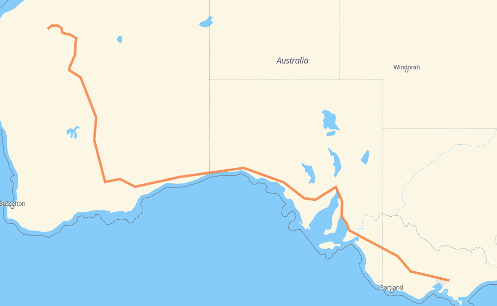
The distance from Yarra Junction to Tom Price is 4,192 kilometers by road including 263 kilometers on motorways. Road takes approximately 47 hours and 12 minutes and goes through Horsham, Murray Bridge, Adelaide, Port Augusta and Kalgoorlie.
How much does it cost to drive from Yarra Junction to Tom Price?
Fuel cost:
593.6 AUD
This fuel cost is calculated as: (Route length 4,192 km / 100 km) * (Fuel consumption 8 L/100 km) * (Fuel price 1.77 AUD / L)
You can adjust fuel consumption and fuel price here.
How long is a car ride from Yarra Junction to Tom Price?
Driving time:
47 h 12 min
This time is calculated for driving at the maximum permitted speed, taking into account traffic rules restrictions.
206 km with a maximum speed 110 km/h = 1 h 52 min
33 km with a maximum speed 100 km/h = 19 min
3,457 km with a maximum speed 90 km/h = 38 h 24 min
402 km with a maximum speed 80 km/h = 5 h 1 min
16 km with a maximum speed 70 km/h = 13 min
66 km with a maximum speed 60 km/h = 1 h 5 min
11 km with a maximum speed 50 km/h = 13 min
1 km with a maximum speed 40 km/h = 1 min
The calculated driving time does not take into account intermediate stops and traffic jams.
How far is Yarra Junction to Tom Price by land?
The distance between Yarra Junction and Tom Price is 4,192 km by road including 263 km on motorways.
Precise satellite coordinates of highways were used for this calculation. The start and finish points are the centers of Yarra Junction and Tom Price respectively.
How far is Yarra Junction to Tom Price by plane?
The shortest distance (air line, as the crow flies) between Yarra Junction and Tom Price is 3,137 km.
This distance is calculated using the Haversine formula as a great-circle distance between two points on the surface of a sphere. The start and finish points are the centers of Yarra Junction and Tom Price respectively. Actual distance between airports may be different.
How many hours is Yarra Junction from Tom Price by plane?
Boeing 737 airliner needs 3 h 55 min to cover the distance of 3,137 km at a cruising speed of 800 km/h.
Small plane "Cessna 172" needs 14 h 15 min to flight this distance at average speed of 220 km/h.
This time is approximate and do not take into account takeoff and landing times, airport location and other real world factors.
How long is a helicopter ride from Yarra Junction to Tom Price?
Fast helicopter "Eurocopter AS350" or "Hughes OH-6 Cayuse" need 13 h 4 min to cover the distance of 3,137 km at a cruising speed of 240 km/h.
Popular "Robinson R44" needs 14 h 56 min to flight this distance at average speed of 210 km/h.
This time is approximate and do not take into account takeoff and landing times, aerodrome location and other real world factors.
What city is halfway between Yarra Junction and Tom Price?
The halfway point between Yarra Junction and Tom Price is Mundrabilla Roadhouse. It is located about 19 km from the exact midpoint by road.
The distance from Mundrabilla Roadhouse to Yarra Junction is 2,115 km and driving will take about 23 h 38 min. The road between Mundrabilla Roadhouse and Tom Price has length 2,077 km and will take approximately 23 h 34 min.
The other cities located close to halfway point:
Eucla is in 2,051 km from Yarra Junction and 2,141 km from Tom Price
Border Village Roadhouse is in 2,039 km from Yarra Junction and 2,153 km from Tom Price
Madura is in 2,233 km from Yarra Junction and 1,959 km from Tom Price
Where is Yarra Junction in relation to Tom Price?
Yarra Junction is located 3,137 km south-east of Tom Price.
Yarra Junction has geographic coordinates: latitude -37.78217, longitude 145.61502.
Tom Price has geographic coordinates: latitude -22.6893, longitude 117.79749.
Which highway goes from Yarra Junction to Tom Price?
The route from Yarra Junction to Tom Price follows A1, 1, A8, 95, 94, M8.