Distance between Marble Bar and Clunes
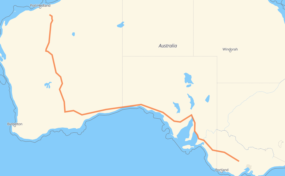
The distance from Marble Bar to Clunes is 4,035 kilometers by road including 90 kilometers on motorways. Road takes approximately 45 hours and 43 minutes and goes through Kalgoorlie, Port Augusta, Murray Bridge and Horsham.
| Shortest distance by air | 2,928 km ✈️ |
| Car route length | 4,035 km 🚗 |
| Driving time | 45 h 43 min |
| Fuel amount | 322.8 L |
| Fuel cost | 571.3 AUD |
| Point | Distance | Time | Fuel | |
| Marble Bar | 0 km | 00 min | 0.0 L | |
|
75 km, 54 min
|
||||
| Nullagine | 75 km | 54 min | 0.7 L | |
|
138 95 462 km, 5 h 16 min
|
||||
| Karalundi | 537 km | 6 h 11 min | 42.0 L | |
|
95 353 km, 4 h 11 min
|
||||
| Leinster | 890 km | 10 h 22 min | 67.6 L | |
|
147 km, 1 h 42 min
|
||||
| Leonora | 1,037 km | 12 h 05 min | 82.3 L | |
|
233 km, 2 h 36 min
|
||||
| Kalgoorlie | 1,270 km | 14 h 41 min | 101.2 L | |
|
94 A1 1,852 km, 20 h 43 min
|
||||
| Port Augusta | 3,122 km | 35 h 24 min | 249.5 L | |
|
A1 380 km, 4 h 10 min
|
||||
| Murray Bridge | 3,502 km | 39 h 35 min | 279.8 L | |
|
M1 A8 342 km, 3 h 54 min
|
||||
| Horsham | 3,844 km | 43 h 30 min | 306.3 L | |
|
A8 C221 192 km, 2 h 13 min
|
||||
| Clunes | 4,035 km | 45 h 43 min | 321.9 L | |
Hotels of Clunes
Frequently Asked Questions
How much does it cost to drive from Marble Bar to Clunes?
Fuel cost: 571.3 AUD
This fuel cost is calculated as: (Route length 4,035 km / 100 km) * (Fuel consumption 8 L/100 km) * (Fuel price 1.77 AUD / L)
You can adjust fuel consumption and fuel price here.
How long is a car ride from Marble Bar to Clunes?
Driving time: 45 h 43 min
This time is calculated for driving at the maximum permitted speed, taking into account traffic rules restrictions.
- 74 km with a maximum speed 110 km/h = 40 min
- 9 km with a maximum speed 100 km/h = 5 min
- 3,394 km with a maximum speed 90 km/h = 37 h 42 min
- 506 km with a maximum speed 80 km/h = 6 h 19 min
- 4 km with a maximum speed 70 km/h = 3 min
- 40 km with a maximum speed 60 km/h = 39 min
- 8 km with a maximum speed 50 km/h = 9 min
- 1 km with a maximum speed 16 km/h = 3 min
The calculated driving time does not take into account intermediate stops and traffic jams.
How far is Marble Bar to Clunes by land?
The distance between Marble Bar and Clunes is 4,035 km by road including 90 km on motorways.
Precise satellite coordinates of highways were used for this calculation. The start and finish points are the centers of Marble Bar and Clunes respectively.
How far is Marble Bar to Clunes by plane?
The shortest distance (air line, as the crow flies) between Marble Bar and Clunes is 2,928 km.
This distance is calculated using the Haversine formula as a great-circle distance between two points on the surface of a sphere. The start and finish points are the centers of Marble Bar and Clunes respectively. Actual distance between airports may be different.
How many hours is Marble Bar from Clunes by plane?
Boeing 737 airliner needs 3 h 39 min to cover the distance of 2,928 km at a cruising speed of 800 km/h.
Small plane "Cessna 172" needs 13 h 18 min to flight this distance at average speed of 220 km/h.
This time is approximate and do not take into account takeoff and landing times, airport location and other real world factors.
How long is a helicopter ride from Marble Bar to Clunes?
Fast helicopter "Eurocopter AS350" or "Hughes OH-6 Cayuse" need 12 h 12 min to cover the distance of 2,928 km at a cruising speed of 240 km/h.
Popular "Robinson R44" needs 13 h 56 min to flight this distance at average speed of 210 km/h.
This time is approximate and do not take into account takeoff and landing times, aerodrome location and other real world factors.
What city is halfway between Marble Bar and Clunes?
The halfway point between Marble Bar and Clunes is Madura. It is located about 37 km from the exact midpoint by road.
The distance from Madura to Marble Bar is 1,980 km and driving will take about 22 h 38 min. The road between Madura and Clunes has length 2,054 km and will take approximately 23 h 5 min.
The other cities located close to halfway point:
Where is Marble Bar in relation to Clunes?
Marble Bar is located 2,928 km north-west of Clunes.
Marble Bar has geographic coordinates: latitude -21.17149, longitude 119.74562.
Clunes has geographic coordinates: latitude -37.29406, longitude 143.78657.
Which highway goes from Marble Bar to Clunes?
The route from Marble Bar to Clunes follows A1, 1, A8, 95, 138, 94.
Other minor sections pass along the road:
- M1: 69 km
- C221: 46 km
- M2: 19 km
- C287: 18 km
- B220: 13 km
- C237: 11 km
- B57: 10 km
- B180: 8 km
- R1: 7 km
- B210: 3 km
- A2: 2 km
- A200: 1 km