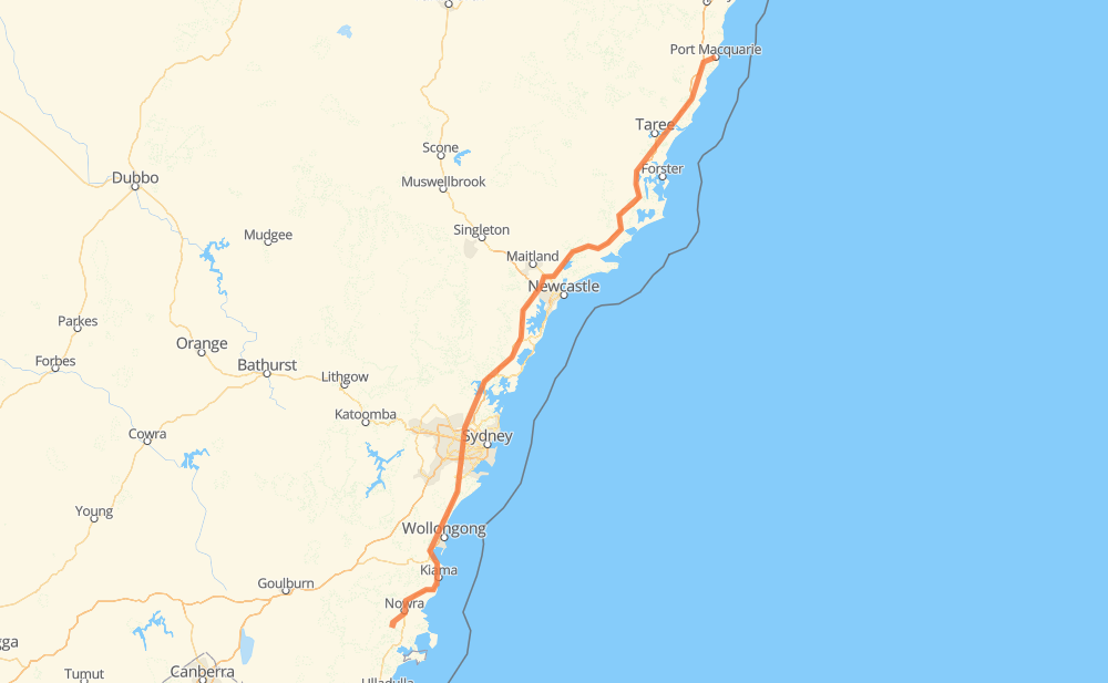
The distance from Port Macquarie to Parma is 552 kilometers by road including 394 kilometers on motorways. Road takes approximately 5 hours and 45 minutes and goes through Sovereign Hills, Johns River, Coopernook, Jones Island, Ghinni Ghinni, Cundletown and Dumaresq Island.
How much does it cost to drive from Port Macquarie to Parma?
Fuel cost:
77.7 AUD
This fuel cost is calculated as: (Route length 552 km / 100 km) * (Fuel consumption 8 L/100 km) * (Fuel price 1.76 AUD / L)
You can adjust fuel consumption and fuel price here.
How long is a car ride from Port Macquarie to Parma?
Driving time:
5 h 45 min
This time is calculated for driving at the maximum permitted speed, taking into account traffic rules restrictions.
297 km with a maximum speed 110 km/h = 2 h 42 min
74 km with a maximum speed 100 km/h = 44 min
70 km with a maximum speed 90 km/h = 46 min
55 km with a maximum speed 80 km/h = 41 min
39 km with a maximum speed 70 km/h = 33 min
13 km with a maximum speed 60 km/h = 13 min
4 km with a maximum speed 50 km/h = 4 min
The calculated driving time does not take into account intermediate stops and traffic jams.
How far is Port Macquarie to Parma by land?
The distance between Port Macquarie and Parma is 552 km by road including 394 km on motorways.
Precise satellite coordinates of highways were used for this calculation. The start and finish points are the centers of Port Macquarie and Parma respectively.
How far is Port Macquarie to Parma by plane?
The shortest distance (air line, as the crow flies) between Port Macquarie and Parma is 451 km.
This distance is calculated using the Haversine formula as a great-circle distance between two points on the surface of a sphere. The start and finish points are the centers of Port Macquarie and Parma respectively. Actual distance between airports may be different.
How many hours is Port Macquarie from Parma by plane?
Boeing 737 airliner needs 33 min to cover the distance of 451 km at a cruising speed of 800 km/h.
Small plane "Cessna 172" needs 2 h 2 min to flight this distance at average speed of 220 km/h.
This time is approximate and do not take into account takeoff and landing times, airport location and other real world factors.
How long is a helicopter ride from Port Macquarie to Parma?
Fast helicopter "Eurocopter AS350" or "Hughes OH-6 Cayuse" need 1 h 52 min to cover the distance of 451 km at a cruising speed of 240 km/h.
Popular "Robinson R44" needs 2 h 8 min to flight this distance at average speed of 210 km/h.
This time is approximate and do not take into account takeoff and landing times, aerodrome location and other real world factors.
What city is halfway between Port Macquarie and Parma?
The halfway point between Port Macquarie and Parma is Morisset. It is located about 2 km from the exact midpoint by road.
The distance from Morisset to Port Macquarie is 273 km and driving will take about 2 h 38 min. The road between Morisset and Parma has length 278 km and will take approximately 3 h 7 min.
The other cities located close to halfway point:
Wyee is in 282 km from Port Macquarie and 270 km from Parma
Cooranbong is in 266 km from Port Macquarie and 286 km from Parma
Halloran is in 289 km from Port Macquarie and 263 km from Parma
Where is Port Macquarie in relation to Parma?
Port Macquarie is located 451 km north-east of Parma.
Port Macquarie has geographic coordinates: latitude -31.42995, longitude 152.91035.
Parma has geographic coordinates: latitude -34.96501, longitude 150.53443.
Which highway goes from Port Macquarie to Parma?
The route from Port Macquarie to Parma follows A1, M1.