Distance between Warracknabeal and Cootamundra
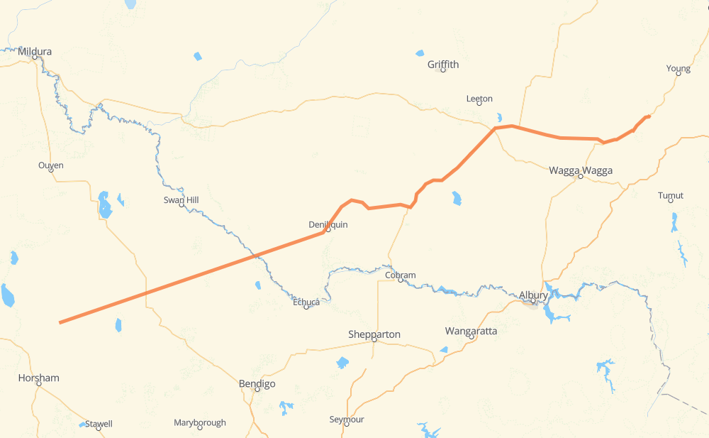
The distance from Warracknabeal to Cootamundra is 626 kilometers by road. Road takes approximately 7 hours and 21 minutes and goes through Birchip, Wycheproof, Kerang, Koondrook, Бархем, Deniliquin and Jerilderie.
| Shortest distance by air | 541 km ✈️ |
| Car route length | 626 km 🚗 |
| Driving time | 7 h 21 min |
| Fuel amount | 50 L |
| Fuel cost | 88.1 AUD |
| Point | Distance | Time | Fuel | |
| Warracknabeal | 0 km | 00 min | 0.0 L | |
|
C242 62 km, 42 min
|
||||
| Birchip | 62 km | 42 min | 4.9 L | |
|
B220 C268 20 km, 13 min
|
||||
| Wycheproof | 82 km | 55 min | 5.5 L | |
|
C261 C262 93 km, 1 h 03 min
|
||||
| Kerang | 175 km | 1 h 59 min | 13.0 L | |
|
C264 14 km, 10 min
|
||||
| Koondrook | 190 km | 2 h 10 min | 15.0 L | |
|
C264 18 km, 12 min
|
||||
| Бархем | 208 km | 2 h 23 min | 15.3 L | |
|
60 km, 44 min
|
||||
| Deniliquin | 267 km | 3 h 07 min | 19.5 L | |
|
B75 84 km, 1 h 01 min
|
||||
| Jerilderie | 351 km | 4 h 08 min | 25.8 L | |
|
A39 132 km, 1 h 29 min
|
||||
| Narrandera | 483 km | 5 h 38 min | 37.8 L | |
|
A39 A41 142 km, 1 h 43 min
|
||||
| Cootamundra | 626 km | 7 h 21 min | 48.2 L | |
Hotels of Cootamundra
Frequently Asked Questions
How much does it cost to drive from Warracknabeal to Cootamundra?
Fuel cost: 88.1 AUD
This fuel cost is calculated as: (Route length 626 km / 100 km) * (Fuel consumption 8 L/100 km) * (Fuel price 1.76 AUD / L)
You can adjust fuel consumption and fuel price here.
How long is a car ride from Warracknabeal to Cootamundra?
Driving time: 7 h 21 min
This time is calculated for driving at the maximum permitted speed, taking into account traffic rules restrictions.
- 529 km with a maximum speed 90 km/h = 5 h 52 min
- 57 km with a maximum speed 80 km/h = 42 min
- 1 km with a maximum speed 70 km/h = 1 min
- 4 km with a maximum speed 60 km/h = 3 min
- 34 km with a maximum speed 50 km/h = 40 min
The calculated driving time does not take into account intermediate stops and traffic jams.
How far is Warracknabeal to Cootamundra by land?
The distance between Warracknabeal and Cootamundra is 626 km by road.
Precise satellite coordinates of highways were used for this calculation. The start and finish points are the centers of Warracknabeal and Cootamundra respectively.
How far is Warracknabeal to Cootamundra by plane?
The shortest distance (air line, as the crow flies) between Warracknabeal and Cootamundra is 541 km.
This distance is calculated using the Haversine formula as a great-circle distance between two points on the surface of a sphere. The start and finish points are the centers of Warracknabeal and Cootamundra respectively. Actual distance between airports may be different.
How many hours is Warracknabeal from Cootamundra by plane?
Boeing 737 airliner needs 40 min to cover the distance of 541 km at a cruising speed of 800 km/h.
Small plane "Cessna 172" needs 2 h 27 min to flight this distance at average speed of 220 km/h.
This time is approximate and do not take into account takeoff and landing times, airport location and other real world factors.
How long is a helicopter ride from Warracknabeal to Cootamundra?
Fast helicopter "Eurocopter AS350" or "Hughes OH-6 Cayuse" need 2 h 15 min to cover the distance of 541 km at a cruising speed of 240 km/h.
Popular "Robinson R44" needs 2 h 34 min to flight this distance at average speed of 210 km/h.
This time is approximate and do not take into account takeoff and landing times, aerodrome location and other real world factors.
What city is halfway between Warracknabeal and Cootamundra?
The halfway point between Warracknabeal and Cootamundra is Conargo. It is located about 1 km from the exact midpoint by road.
The distance from Conargo to Warracknabeal is 312 km and driving will take about 3 h 41 min. The road between Conargo and Cootamundra has length 314 km and will take approximately 3 h 40 min.
The other cities located close to halfway point:
Where is Warracknabeal in relation to Cootamundra?
Warracknabeal is located 541 km south-west of Cootamundra.
Warracknabeal has geographic coordinates: latitude -36.25103, longitude 142.39535.
Cootamundra has geographic coordinates: latitude -34.63945, longitude 148.02572.
Which highway goes from Warracknabeal to Cootamundra?
The route from Warracknabeal to Cootamundra follows A39.
Other minor sections pass along the road:
- A41: 51 km
- C242: 50 km
- C262: 47 km
- C264: 26 km
- C261: 25 km
- C268: 12 km
- B220: 9 km
- B75: 4 km
- C234: 2 km
- B400: 1 km
- B85: 1 km