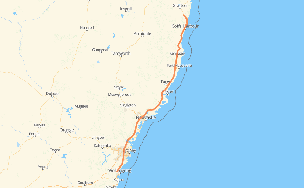
The distance from Cordeaux to Halfway Creek is 661 kilometers by road including 560 kilometers on motorways. Road takes approximately 6 hours and 41 minutes and goes through Coffs Harbour, Dombarton, Kembla Heights, Cataract, Mount Keira, Bulli and Helensburgh.
How much does it cost to drive from Cordeaux to Halfway Creek?
Fuel cost:
95.1 AUD
This fuel cost is calculated as: (Route length 661 km / 100 km) * (Fuel consumption 8 L/100 km) * (Fuel price 1.8 AUD / L)
You can adjust fuel consumption and fuel price here.
How long is a car ride from Cordeaux to Halfway Creek?
Driving time:
6 h 41 min
This time is calculated for driving at the maximum permitted speed, taking into account traffic rules restrictions.
477 km with a maximum speed 110 km/h = 4 h 20 min
75 km with a maximum speed 100 km/h = 45 min
8 km with a maximum speed 90 km/h = 5 min
40 km with a maximum speed 80 km/h = 29 min
28 km with a maximum speed 70 km/h = 24 min
16 km with a maximum speed 60 km/h = 16 min
17 km with a maximum speed 50 km/h = 20 min
The calculated driving time does not take into account intermediate stops and traffic jams.
How far is Cordeaux to Halfway Creek by land?
The distance between Cordeaux and Halfway Creek is 661 km by road including 560 km on motorways.
Precise satellite coordinates of highways were used for this calculation. The start and finish points are the centers of Cordeaux and Halfway Creek respectively.
How far is Cordeaux to Halfway Creek by plane?
The shortest distance (air line, as the crow flies) between Cordeaux and Halfway Creek is 541 km.
This distance is calculated using the Haversine formula as a great-circle distance between two points on the surface of a sphere. The start and finish points are the centers of Cordeaux and Halfway Creek respectively. Actual distance between airports may be different.
How many hours is Cordeaux from Halfway Creek by plane?
Boeing 737 airliner needs 40 min to cover the distance of 541 km at a cruising speed of 800 km/h.
Small plane "Cessna 172" needs 2 h 27 min to flight this distance at average speed of 220 km/h.
This time is approximate and do not take into account takeoff and landing times, airport location and other real world factors.
How long is a helicopter ride from Cordeaux to Halfway Creek?
Fast helicopter "Eurocopter AS350" or "Hughes OH-6 Cayuse" need 2 h 15 min to cover the distance of 541 km at a cruising speed of 240 km/h.
Popular "Robinson R44" needs 2 h 34 min to flight this distance at average speed of 210 km/h.
This time is approximate and do not take into account takeoff and landing times, aerodrome location and other real world factors.
What city is halfway between Cordeaux and Halfway Creek?
The halfway point between Cordeaux and Halfway Creek is Bulahdelah. It is located about 1 km from the exact midpoint by road.
The distance from Bulahdelah to Cordeaux is 329 km and driving will take about 3 h 32 min. The road between Bulahdelah and Halfway Creek has length 332 km and will take approximately 3 h 9 min.
The other cities located close to halfway point:
Nerong is in 319 km from Cordeaux and 342 km from Halfway Creek
Coolongolook is in 363 km from Cordeaux and 297 km from Halfway Creek
Wang Wauk is in 368 km from Cordeaux and 293 km from Halfway Creek
Where is Cordeaux in relation to Halfway Creek?
Cordeaux is located 541 km south-west of Halfway Creek.
Cordeaux has geographic coordinates: latitude -34.38861, longitude 150.77944.
Halfway Creek has geographic coordinates: latitude -29.92406, longitude 153.07086.
Which highway goes from Cordeaux to Halfway Creek?
The route from Cordeaux to Halfway Creek follows M1, A1.