Distance between Ivanhoe and Kingston SE
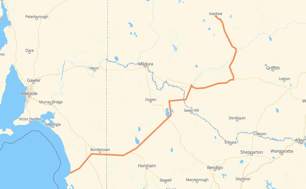
The distance from Ivanhoe to Kingston SE is 866 kilometers by road. Road takes approximately 9 hours and 58 minutes and goes through Hay, Balranald, Manangatang, Sea Lake, Hopetoun, Rainbow and Nhill.
| Shortest distance by air | 598 km ✈️ |
| Car route length | 866 km 🚗 |
| Driving time | 9 h 58 min |
| Fuel amount | 69.3 L |
| Fuel cost | 124.7 AUD |
| Point | Distance | Time | Fuel | |
| Ivanhoe | 0 km | 00 min | 0.0 L | |
|
B75 197 km, 2 h 12 min
|
||||
| Hay | 197 km | 2 h 12 min | 14.6 L | |
|
B75 A20 156 km, 1 h 44 min
|
||||
| Balranald | 352 km | 3 h 57 min | 26.8 L | |
|
MR 694 87 km, 59 min
|
||||
| Manangatang | 440 km | 4 h 57 min | 31.6 L | |
|
C251 52 km, 34 min
|
||||
| Sea Lake | 491 km | 5 h 31 min | 39.2 L | |
|
A79 B200 59 km, 40 min
|
||||
| Hopetoun | 550 km | 6 h 11 min | 43.9 L | |
|
C227 33 km, 22 min
|
||||
| Rainbow | 583 km | 6 h 33 min | 44.1 L | |
|
C227 85 km, 57 min
|
||||
| Nhill | 668 km | 7 h 31 min | 50.4 L | |
|
A8 44 km, 30 min
|
||||
| Kaniva | 711 km | 8 h 01 min | 56.5 L | |
|
A8 156 km, 1 h 57 min
|
||||
| Kingston SE | 867 km | 9 h 58 min | 67.6 L | |
Hotels of Kingston SE
Frequently Asked Questions
How much does it cost to drive from Ivanhoe to Kingston SE?
Fuel cost: 124.7 AUD
This fuel cost is calculated as: (Route length 866 km / 100 km) * (Fuel consumption 8 L/100 km) * (Fuel price 1.8 AUD / L)
You can adjust fuel consumption and fuel price here.
How long is a car ride from Ivanhoe to Kingston SE?
Driving time: 9 h 58 min
This time is calculated for driving at the maximum permitted speed, taking into account traffic rules restrictions.
- 773 km with a maximum speed 90 km/h = 8 h 35 min
- 61 km with a maximum speed 80 km/h = 45 min
- 9 km with a maximum speed 60 km/h = 8 min
- 24 km with a maximum speed 50 km/h = 28 min
The calculated driving time does not take into account intermediate stops and traffic jams.
How far is Ivanhoe to Kingston SE by land?
The distance between Ivanhoe and Kingston SE is 866 km by road.
Precise satellite coordinates of highways were used for this calculation. The start and finish points are the centers of Ivanhoe and Kingston SE respectively.
How far is Ivanhoe to Kingston SE by plane?
The shortest distance (air line, as the crow flies) between Ivanhoe and Kingston SE is 598 km.
This distance is calculated using the Haversine formula as a great-circle distance between two points on the surface of a sphere. The start and finish points are the centers of Ivanhoe and Kingston SE respectively. Actual distance between airports may be different.
How many hours is Ivanhoe from Kingston SE by plane?
Boeing 737 airliner needs 44 min to cover the distance of 598 km at a cruising speed of 800 km/h.
Small plane "Cessna 172" needs 2 h 43 min to flight this distance at average speed of 220 km/h.
This time is approximate and do not take into account takeoff and landing times, airport location and other real world factors.
How long is a helicopter ride from Ivanhoe to Kingston SE?
Fast helicopter "Eurocopter AS350" or "Hughes OH-6 Cayuse" need 2 h 29 min to cover the distance of 598 km at a cruising speed of 240 km/h.
Popular "Robinson R44" needs 2 h 50 min to flight this distance at average speed of 210 km/h.
This time is approximate and do not take into account takeoff and landing times, aerodrome location and other real world factors.
What city is halfway between Ivanhoe and Kingston SE?
The halfway point between Ivanhoe and Kingston SE is Manangatang. It is located about 7 km from the exact midpoint by road.
The distance from Manangatang to Ivanhoe is 440 km and driving will take about 4 h 56 min. The road between Manangatang and Kingston SE has length 426 km and will take approximately 5 h 1 min.
The other cities located close to halfway point:
Where is Ivanhoe in relation to Kingston SE?
Ivanhoe is located 598 km north-east of Kingston SE.
Ivanhoe has geographic coordinates: latitude -32.89669, longitude 144.30069.
Kingston SE has geographic coordinates: latitude -36.83918, longitude 139.8471.
Which highway goes from Ivanhoe to Kingston SE?
The route from Ivanhoe to Kingston SE follows B75, A20.
Other minor sections pass along the road:
- A8: 85 km
- C251: 55 km
- MR 694: 49 km
- B12: 45 km
- C223: 41 km
- C227: 39 km
- B200: 24 km
- Mallee Street: 21 km
- C245: 10 km
- B57: 6 km
- B1: 4 km
- A79: 3 km
- B400: 2 km
- B220: 1 km
- B101: 1 km
- A66: 1 km