Distance between Normanton and Hawker
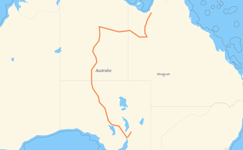
The distance from Normanton to Hawker is 2,998 kilometers by road. Road takes approximately 33 hours and 34 minutes and goes through Mount Isa, Alice Springs, Port Augusta, Cloncurry, Tennant Creek, Coober Pedy and Mount Eba.
| Shortest distance by air | 1,604 km ✈️ |
| Car route length | 2,998 km 🚗 |
| Driving time | 33 h 34 min |
| Fuel amount | 239.8 L |
| Fuel cost | 431.7 AUD |
| Point | Distance | Time | Fuel | |
| Normanton | 0 km | 00 min | 0.0 L | |
|
83 383 km, 4 h 16 min
|
||||
| Cloncurry | 383 km | 4 h 16 min | 30.1 L | |
|
83 113 km, 1 h 16 min
|
||||
| Mount Isa | 496 km | 5 h 33 min | 38.7 L | |
|
A2 66 663 km, 7 h 25 min
|
||||
| Tennant Creek | 1,159 km | 12 h 58 min | 92.7 L | |
|
87 507 km, 5 h 40 min
|
||||
| Alice Springs | 1,666 km | 18 h 38 min | 133.1 L | |
|
87 A87 681 km, 7 h 36 min
|
||||
| Coober Pedy | 2,347 km | 26 h 14 min | 184.3 L | |
|
A87 164 km, 1 h 49 min
|
||||
| Mount Eba | 2,511 km | 28 h 03 min | 199.7 L | |
|
A87 168 km, 1 h 51 min
|
||||
| Wirraminna | 2,679 km | 29 h 55 min | 211.1 L | |
|
A87 215 km, 2 h 24 min
|
||||
| Port Augusta | 2,893 km | 32 h 20 min | 231.3 L | |
|
A1 B83 104 km, 1 h 13 min
|
||||
| Hawker | 2,998 km | 33 h 34 min | 237.9 L | |
Frequently Asked Questions
How much does it cost to drive from Normanton to Hawker?
Fuel cost: 431.7 AUD
This fuel cost is calculated as: (Route length 2,998 km / 100 km) * (Fuel consumption 8 L/100 km) * (Fuel price 1.8 AUD / L)
You can adjust fuel consumption and fuel price here.
How long is a car ride from Normanton to Hawker?
Driving time: 33 h 34 min
This time is calculated for driving at the maximum permitted speed, taking into account traffic rules restrictions.
- 2,905 km with a maximum speed 90 km/h = 32 h 16 min
- 60 km with a maximum speed 80 km/h = 45 min
- 6 km with a maximum speed 70 km/h = 5 min
- 22 km with a maximum speed 60 km/h = 22 min
- 4 km with a maximum speed 50 km/h = 4 min
The calculated driving time does not take into account intermediate stops and traffic jams.
How far is Normanton to Hawker by land?
The distance between Normanton and Hawker is 2,998 km by road.
Precise satellite coordinates of highways were used for this calculation. The start and finish points are the centers of Normanton and Hawker respectively.
How far is Normanton to Hawker by plane?
The shortest distance (air line, as the crow flies) between Normanton and Hawker is 1,604 km.
This distance is calculated using the Haversine formula as a great-circle distance between two points on the surface of a sphere. The start and finish points are the centers of Normanton and Hawker respectively. Actual distance between airports may be different.
How many hours is Normanton from Hawker by plane?
Boeing 737 airliner needs 2 h to cover the distance of 1,604 km at a cruising speed of 800 km/h.
Small plane "Cessna 172" needs 7 h 17 min to flight this distance at average speed of 220 km/h.
This time is approximate and do not take into account takeoff and landing times, airport location and other real world factors.
How long is a helicopter ride from Normanton to Hawker?
Fast helicopter "Eurocopter AS350" or "Hughes OH-6 Cayuse" need 6 h 41 min to cover the distance of 1,604 km at a cruising speed of 240 km/h.
Popular "Robinson R44" needs 7 h 38 min to flight this distance at average speed of 210 km/h.
This time is approximate and do not take into account takeoff and landing times, aerodrome location and other real world factors.
What city is halfway between Normanton and Hawker?
The halfway point between Normanton and Hawker is Pmara Jutunta. It is located about 15 km from the exact midpoint by road.
The distance from Pmara Jutunta to Normanton is 1,484 km and driving will take about 16 h 35 min. The road between Pmara Jutunta and Hawker has length 1,514 km and will take approximately 16 h 58 min.
The other cities located close to halfway point:
Where is Normanton in relation to Hawker?
Normanton is located 1,604 km north of Hawker.
Normanton has geographic coordinates: latitude -17.67092, longitude 141.07803.
Hawker has geographic coordinates: latitude -31.88762, longitude 138.42271.
Which highway goes from Normanton to Hawker?
The route from Normanton to Hawker follows A87, 87, 83, 66, A2.
Other minor sections pass along the road:
- B83: 99 km
- A1: 8 km
- 1: 2 km
- 84: 1 km