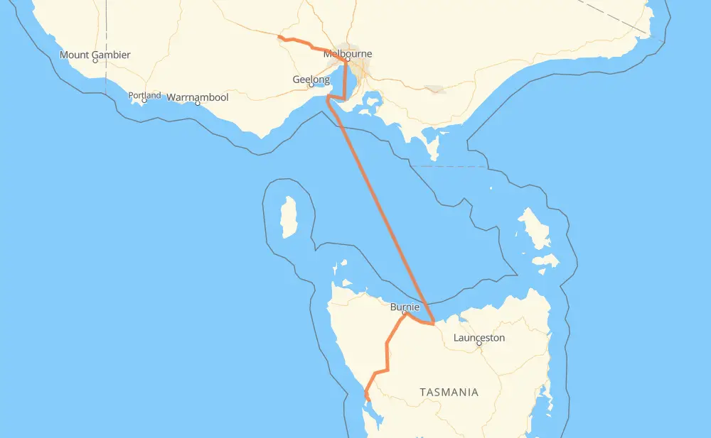
Distance between Strahan and Mitchell Park
The distance from Strahan to Mitchell Park is 783 kilometers by road including 161 kilometers on motorways. Road takes approximately 25 hours and 30 minutes and goes through Devonport, Zeehan, Rosebery, Ridgley, Round Hill, Penguin and Ulverstone.
| Shortest distance by air | 532 km ✈️ |
| Car route length | 783 km 🚗 |
| Driving time | 25 h 30 min |
| Fuel amount | 62.7 L |
| Fuel cost | 111.5 AUD |
| Point | Distance | Time | Fuel | |
| Strahan | 0 km | 00 min | 0.0 L | |
|
B27 42 km, 28 min
|
||||
| Zeehan | 42 km | 28 min | 2.8 L | |
|
B27 A10 28 km, 19 min
|
||||
| Rosebery | 70 km | 48 min | 5.1 L | |
|
A10 91 km, 1 h 01 min
|
||||
| Ridgley | 160 km | 1 h 49 min | 11.9 L | |
|
B18 C112 21 km, 15 min
|
||||
| Round Hill | 181 km | 2 h 05 min | 14.4 L | |
|
1 14 km, 08 min
|
||||
| Penguin | 195 km | 2 h 13 min | 15.2 L | |
|
1 12 km, 06 min
|
||||
| Ulverstone | 207 km | 2 h 20 min | 16.1 L | |
|
1 6 km, 03 min
|
||||
| Turners Beach | 213 km | 2 h 23 min | 17.0 L | |
|
1 15 km, 08 min
|
||||
| Devonport | 228 km | 2 h 32 min | 18.2 L | |
|
M8 556 km, 22 h 58 min
|
||||
| Mitchell Park | 784 km | 25 h 30 min | 62.4 L | |
Frequently Asked Questions
How much does it cost to drive from Strahan to Mitchell Park?
Fuel cost: 111.5 AUD
This fuel cost is calculated as: (Route length 783 km / 100 km) * (Fuel consumption 8 L/100 km) * (Fuel price 1.78 AUD / L)
You can adjust fuel consumption and fuel price here.
How long is a car ride from Strahan to Mitchell Park?
Driving time: 25 h 30 min
This time is calculated for driving at the maximum permitted speed, taking into account traffic rules restrictions.
- 114 km with a maximum speed 110 km/h = 1 h 2 min
- 31 km with a maximum speed 100 km/h = 18 min
- 157 km with a maximum speed 90 km/h = 1 h 44 min
- 34 km with a maximum speed 80 km/h = 25 min
- 9 km with a maximum speed 60 km/h = 8 min
- 3 km with a maximum speed 50 km/h = 3 min
- 436 km with a maximum speed 20 km/h = 21 h 47 min
The calculated driving time does not take into account intermediate stops and traffic jams.
How far is Strahan to Mitchell Park by land?
The distance between Strahan and Mitchell Park is 783 km by road including 161 km on motorways.
Precise satellite coordinates of highways were used for this calculation. The start and finish points are the centers of Strahan and Mitchell Park respectively.
How far is Strahan to Mitchell Park by plane?
The shortest distance (air line, as the crow flies) between Strahan and Mitchell Park is 532 km.
This distance is calculated using the Haversine formula as a great-circle distance between two points on the surface of a sphere. The start and finish points are the centers of Strahan and Mitchell Park respectively. Actual distance between airports may be different.
How many hours is Strahan from Mitchell Park by plane?
Boeing 737 airliner needs 39 min to cover the distance of 532 km at a cruising speed of 800 km/h.
Small plane "Cessna 172" needs 2 h 25 min to flight this distance at average speed of 220 km/h.
This time is approximate and do not take into account takeoff and landing times, airport location and other real world factors.
How long is a helicopter ride from Strahan to Mitchell Park?
Fast helicopter "Eurocopter AS350" or "Hughes OH-6 Cayuse" need 2 h 13 min to cover the distance of 532 km at a cruising speed of 240 km/h.
Popular "Robinson R44" needs 2 h 32 min to flight this distance at average speed of 210 km/h.
This time is approximate and do not take into account takeoff and landing times, aerodrome location and other real world factors.
What city is halfway between Strahan and Mitchell Park?
The halfway point between Strahan and Mitchell Park is Port Melbourne. It is located about 58 km from the exact midpoint by road.
The distance from Port Melbourne to Strahan is 450 km and driving will take about 13 h 29 min. The road between Port Melbourne and Mitchell Park has length 334 km and will take approximately 12 h 1 min.
Where is Strahan in relation to Mitchell Park?
Strahan is located 532 km south-east of Mitchell Park.
Strahan has geographic coordinates: latitude -42.15254, longitude 145.32821.
Mitchell Park has geographic coordinates: latitude -37.51439, longitude 143.80717.
Which highway goes from Strahan to Mitchell Park?
The route from Strahan to Mitchell Park follows M8.
Other minor sections pass along the road:
- A10: 78 km
- B18: 50 km
- B27: 47 km
- 1: 46 km
- M1: 8 km
- C112: 4 km
- M80: 4 km